
GRAND STAIRCASE-ESCALANTE: Photographs of a Monumental Landscape
Text: Andreea Lotak; Photos: Justin & Andreea Lotak · 6 min read

The narrow “Spooky Canyon”
Noel Poe, President of the Board of Directors of Grand Staircase Escalante Partners: “There are a lot of unique places [in the monument], but any slot canyon is my favorite. Slot canyons are something that’s unique to the Colorado Plateau. My wife and I ride horseback and we love to take the horses into the slot canyons, where we sit in the saddle and reach out and touch both walls. It’s an experience that most people never had, particularly horseback. The canyons may be 50ft to 100ft tall, so when you’re at the bottom and see this little bit of blue sky above you, you think ‘Is there going to be a rainstorm today? Should I really be in here?’ (laughs). But the slot canyons are spectacular. Anybody that goes into them is immediately impressed.” — excerpt from interview published here.
The boundaries of this national monument have been the subject of many complaints, but have also created one of the most beloved protected public lands. Two decades after its designation, the current president wants to carve out many hundreds of thousands of acres from the Grand Staircase-Escalante and split it into three different national monuments. Now the decision is going to court.
For a few days this fall we hiked, backpacked, drove and camped throughout the national monument, crisscrossing it from north to south in an attempt to witness its full beauty. At 1.88 million acres, it is the largest land-based monument designated through the Antiquities Act. Its size was the main subject of debate, with critics arguing that it doesn’t respect the clause of confining the monument to “the smallest area compatible with the proper care and management of the objects to be protected”. As with the case of Bears Ears, Secretary Zinke spoke about the importance of identifying these objects of interest and then conserving them within several different monuments smaller in size. This idea of a mosaic of protected lands comes from an age where the mainstream understanding of ecology was more limited than it is today. Biological corridors that connect these areas are essential for the health of their ecosystems. The importance of those objects to be protected can be harmed if we surround them by developments, highways or mining projects. The large size of the Grand Staircase-Escalante protected a fluid landscape, where animals and plants could continue to migrate and adapt. The health of its ecosystem created the wild beauty that attracts so many to visit. The fact that this place remained almost unaltered throughout the century following European settlement was also because mining in such remote country required technology that didn’t exist at the time, but that is advancing now enough to make resource extraction economically viable. Its recent past doesn’t guarantee its future. That’s why it was protected.
After spending time in this vast landscape and speaking with people, we understood that beyond economic arguments, it’s also a question of cultural identities. Some of the descendants of European settlers remain distrustful of the federal government owning land in Utah, and some feel much more attached to the tradition of extractive industries that were established by their forefathers. On the other hand, this land’s existence was marked for much longer by a very different cultural approach: that of native tribes, whose artifacts are scattered all across Grand Staircase-Escalante and whose way of life didn’t significantly alter the natural environment. The photographs below are dedicated to them, and to the people whose vision and stewardship kept these lands beautiful and healthy, including some of the men and women who graze their cattle here consciously and know the land better than many. The legacy of all of them is currently threatened by those who represent the interest of a few and manipulate the cultural divisions among us.

The land that hides twisted slot canyons as seen from above, at the Spooky and Peekaboo canyons trailhead.

Amazing formations in the Devils Garden Outstanding Natural Area along the Hole-in-the-Rock scenic road.
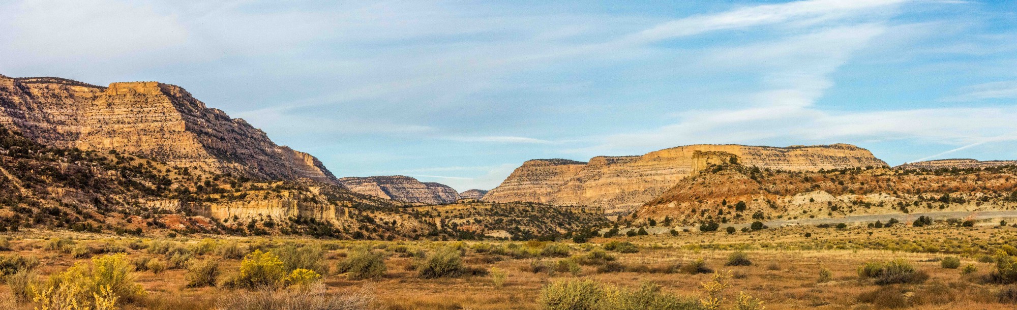
Cutting through the Kaiparowits Plateau region along Rte 230

A bobcat after sunset right below the Straight Cliffs formation, at the eastern edge of the Kaiparowits Plateau.

Left: The 57 miles Hole-in-the-Rock Scenic Backway, which was excluded from the national monument in the current presidential plans. Garfield county is working now with the BLM to improve the state of the road and make it more drivable, as it is constantly damaged by rains and heavy use. Right: The Straight Cliffs, at the edge of the Kaiparowits Plateau. Cows can be seen dotting the landscape, as grazing is allowed in the national monument. The region of the Kaiparowits formation has become in the past two decades one of the best places on the planet for finding dinosaur fossils from the late Cretaceous Era when an asteroid hit the Earth. At least 12 new dinosaur species were discovered in the monument in the last decade and a half. Parts of the Kaiparowits Plateau also contain important coal resources and were carved out of the monument in the president’s proposal.

Approaching the Cottownwood Narrows along the Cottonwood Road Scenic Backway, you are surrounded by an otherworldly landscape of colorful sandstone and rock formations.
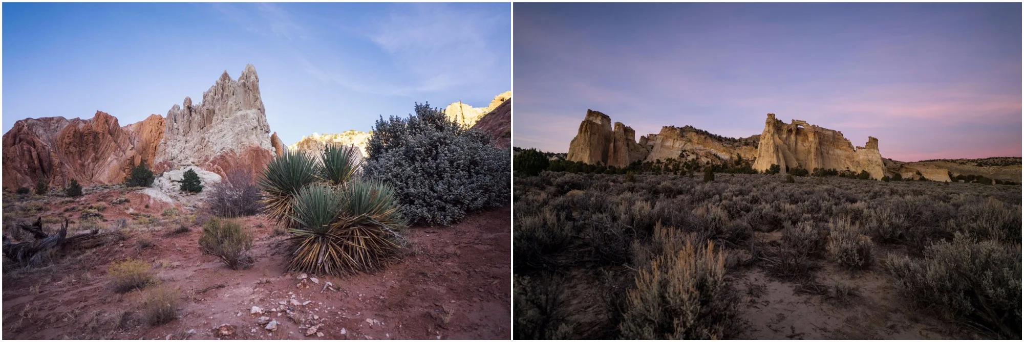
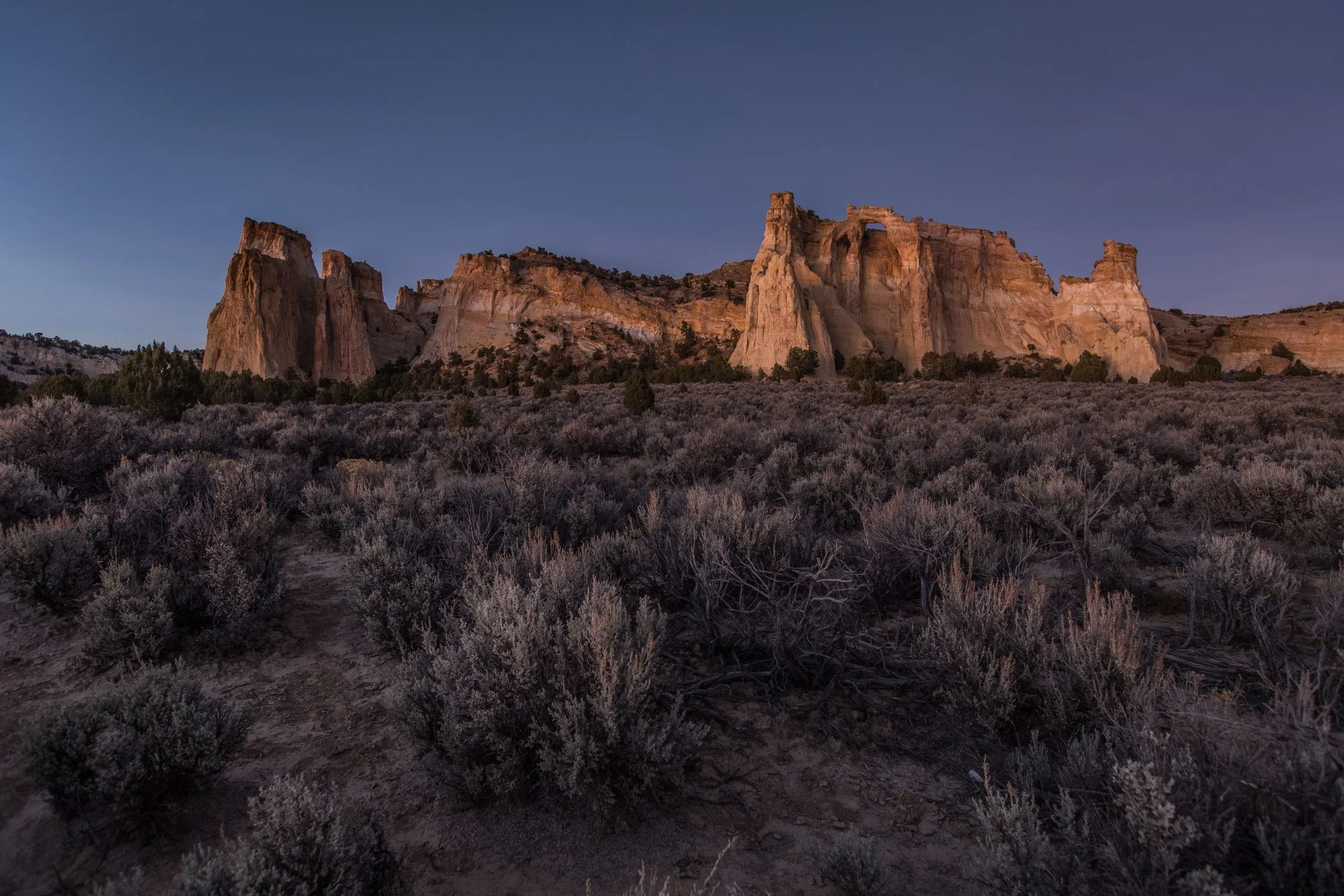
Left: The beautiful landscape at the Cottonwood Narrows North trailhead. Right: Grosvenor Arch

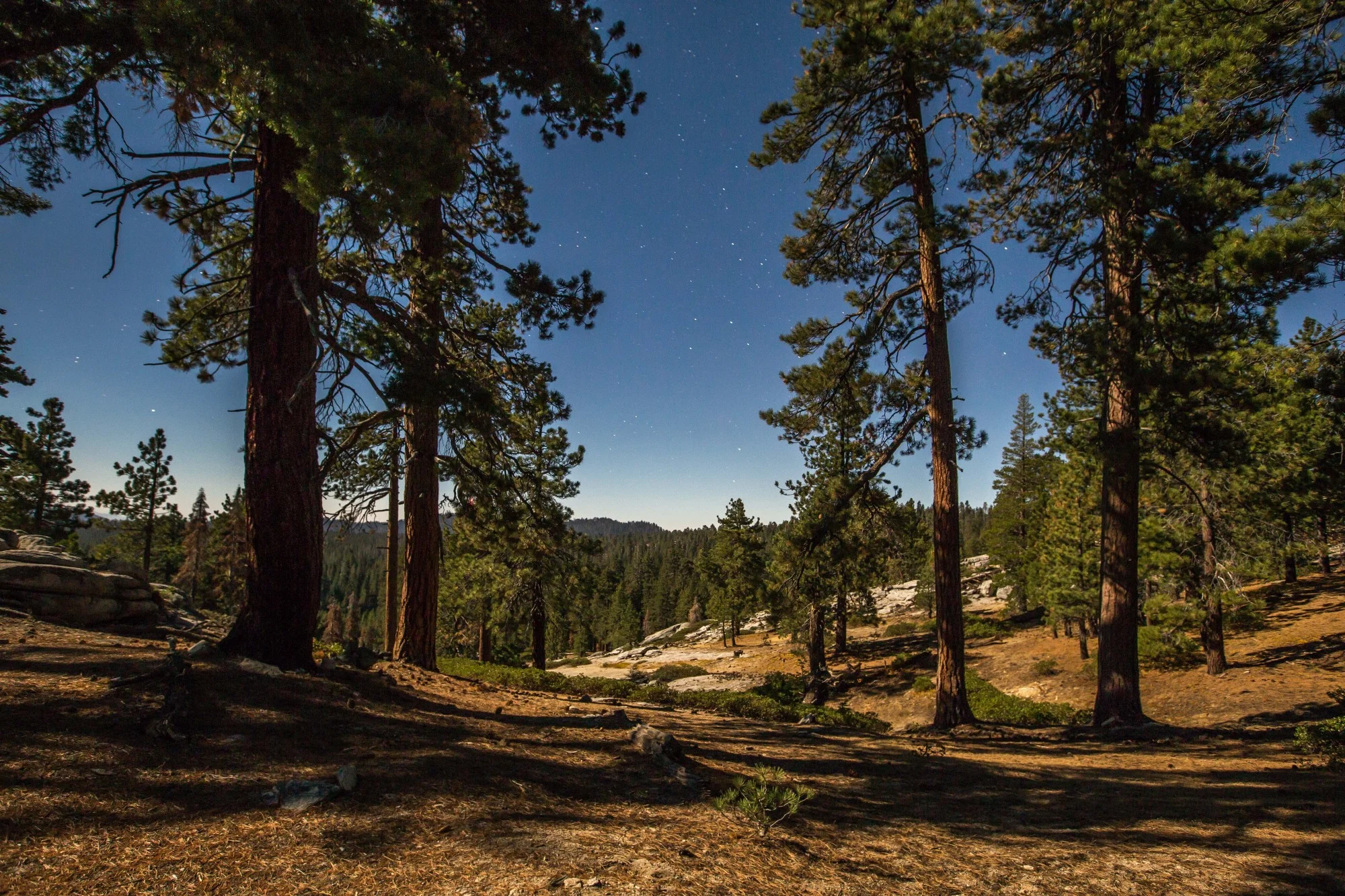
Ponderosa pines magically shooting from one of the walls of the Escalante River gorge.

Right: A Fremont cottonwood in bright fall colors. For many Native people these trees found in riparian zones of the Southwest held a sacred importance and their bark was used for treating Vitamin C deficiency and other ailments. Right: The Escalante River carves many of the slot canyons in the national monument and is the site of one of the largest watershed restoration projects in the country. Grand Staircase Escalante Partners, together with some thirty other agencies and organizations, are working annually to remove invasive vegetation and restore native habitat.

The overnight hike from the Escalante Town trailhead to the Escalante River trailhead takes you through the river gorge with towering walls, arches, cottonwoods, and dozens of river crossings. It’s a beautiful way to explore the waterway that carves so many of the impressive canyons in the national monument.

Left: A view of one of the walls of the river gorge. Right: One of the arches to be spotted along the river gorge trail.

The full moon lit up the rock walls in the Escalante River gorge.


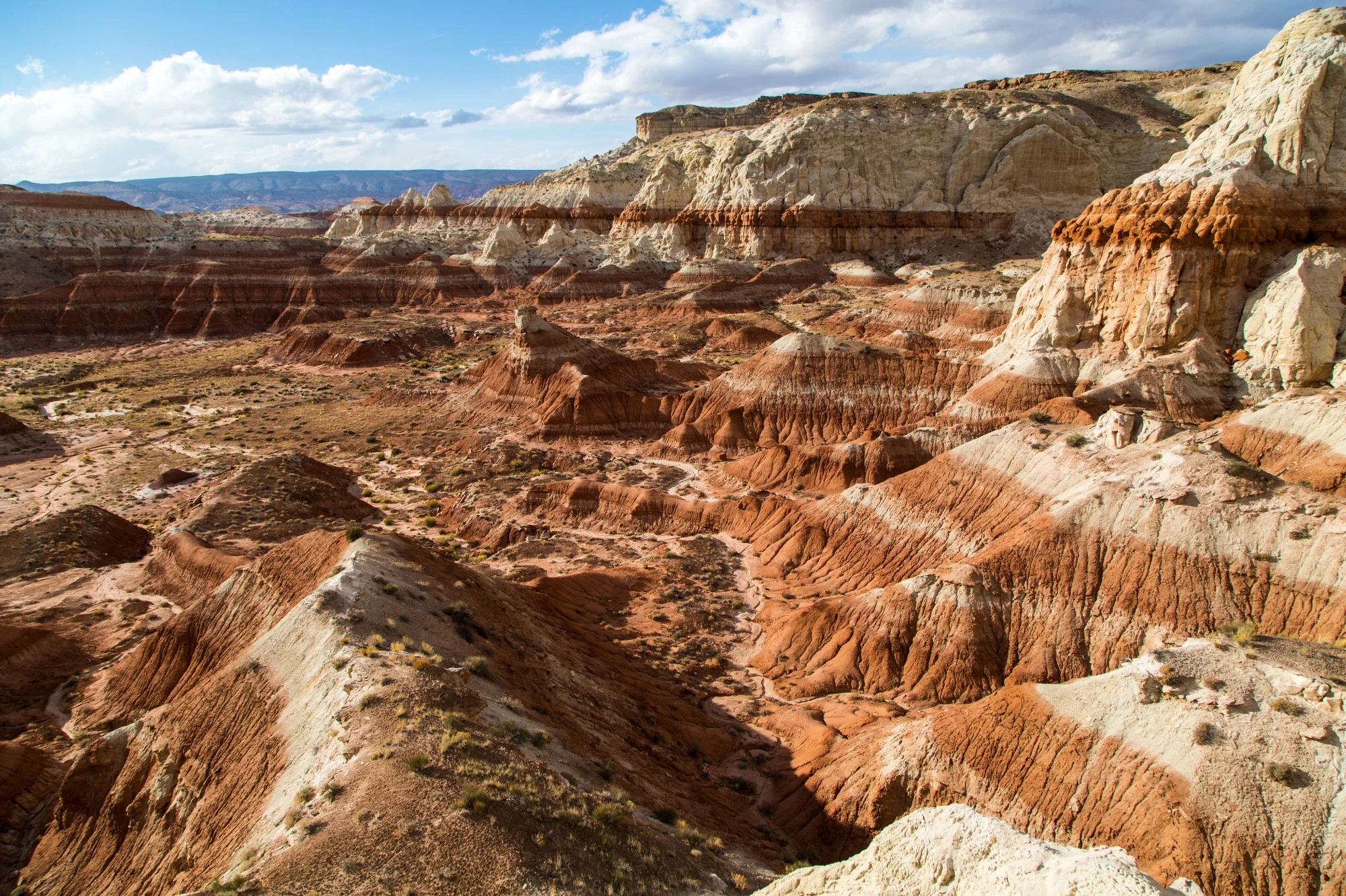
The Toadstools have become one of the most popular sites in the Grand Staircase-Escalante, with easy access from the highway. Under the current plans this area is no longer contained within a national monument boundary.

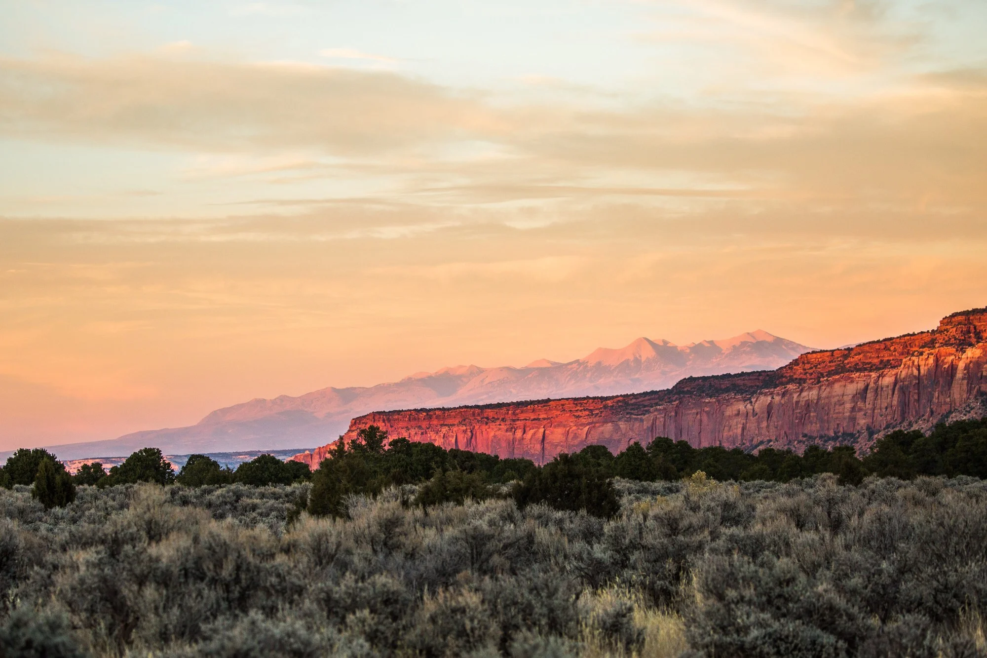
Some of the impressive canyons at the southern end of the Grand Staircase-Escalante National Monument
If you wish to get involved and keep up with the latest actions to protect Grand Staircase-Escalante National Monument, follow the work of Grand Staircase Escalante Partners.


To date, President Joe Biden has designated five national monuments since coming to office in 2021. Here we take a look at four of those five national monuments that had a land conservation element, and what might be on the slate before the end of his first term.