HANFORD REACH NATIONAL MONUMENT: Rare Grasslands on the Columbia River
Text: Andreea Lotak; Photos: Andreea & Justin Lotak · 8 min read

Sun sets over the dunes in Hanford Reach National Monument, Washington
This could be one of the most special national monuments in the US. Its story is an impressive one, and its beauty a hidden type, one that doesn’t stand out from the first moment you approach it. Located along one of the last free-flowing sections of the Columbia River in Washington, it’s a U-shaped protected area surrounding what was once known as the most polluted place in the Western hemisphere.
The Hanford Site, an integral part of the Manhattan Project where plutonium for the first atomic bombs was produced, is now undergoing an expensive clean-up operation and remains off-limits to the public. The quiet Hanford Reach National Monument and its biodiversity became the beneficiaries of this unlikely ally: the area remained undeveloped and wild as a buffer zone to the highly secret facility.

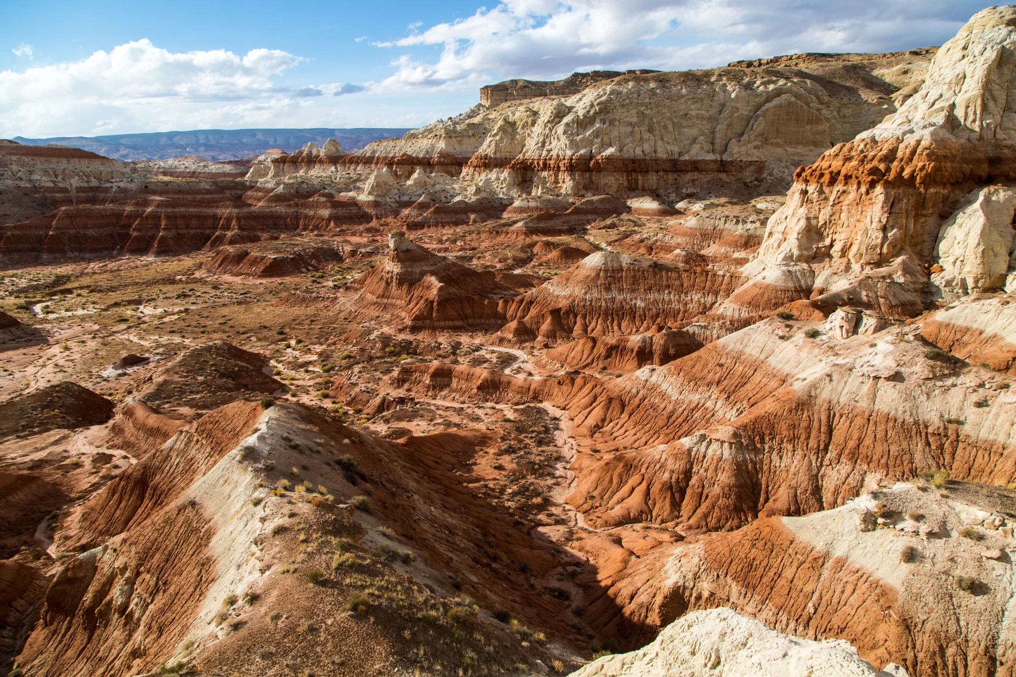
A sample of the grasslands covering most of the national monument. It's these kinds of ecosystems that have been commonly disregarded for conservation and have been covered by ranch and farmlands, as well as urban developments. However, they host an incredible biodiversity of reptiles, mammals and plant life.
Along the monument, a stretch of 51 miles of the Columbia is the last remaining free-flowing portion of the 1,212 miles of this once mighty river. Not far up stream, massive dams produce electricity and irrigation for one of the most diverse agricultural regions of the US. In the 80s and all throughout the 90s local groups and politicians fought to see this buffer zone protected through a Wild & Scenic River designation by Congress, so that dams and agriculture wouldn’t advance in some of the last wild places of this corner of Washington. Eventually, it was protected under the Antiquities Act in 2000 by President Clinton, as Congress never arrived to an agreement. Some of the agricultural interest groups sued to see the decision reversed, but lost.
Now, as we approached the monument managed by the National Wildlife Refuge system, we saw crops of all kinds surrounding it from every direction. Irrigation canals run through the monument and the adjacent Saddle Mountain Wildlife Refuge, carrying the water from the Columbia, which even dammed continues to be a massive river. Within the monument some of the last remaining portions of original grassland vegetation dominated by sagebrush bent in the hot breeze of summer. It was quiet, with just a few motor boats passing by every now and then. A few vehicles driven by local hunters were on the lookout for mule deer and elk. Porcupines, lizards, coyotes, frogs, shore birds, ducks and many other species call this forgotten place home as well.

white bluffs hike
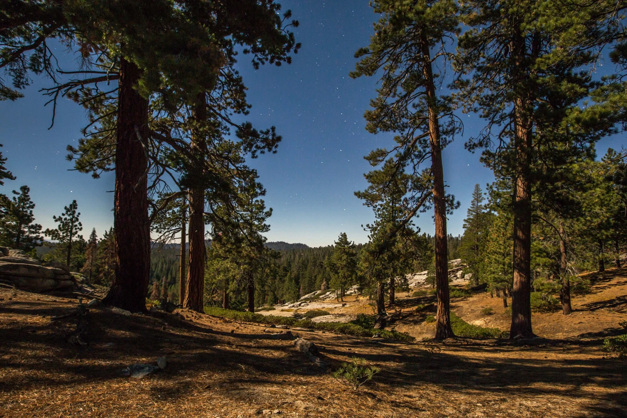
Hiking up on the Columbia Plateau, on our way to explore the massive sand dunes of the White Bluffs hike. For more information on the trail see here.
We drove around the morning of a late August day, with the sun scorching the horizon. A system of unpaved roads criss-cross the area, with massive power lines going along them. Their buzz filled the air and the wildlife seemed to be taking refuge from the coming heat of the day. There were signs and a few information panels, giving some insight into the local complicated history and the importance of the monument. It certainly wasn't as impressive a sight as that of other places we’ve seen. That’s important to recognize, because our esthetic standards have many times defined the decisions to protect an area and sacrifice another. This place would have likely disappeared had it not been for its part as a buffer zone to a nuclear site.
Instead, it’s this apparently flat, dry wilderness crossed by power lines. Getting off the car and walking around, we noticed the footprints in the sand of the road. Some species of cat, coyotes, lizards, snakes, humans, and deer, all passed by. That’s the first testimony to the biodiversity of the monument. Within the layers of the cliff formations of the Columbia Plateau, scientists have discovered fossils of the great migrations from tens of thousands of years ago, when zebras, giant bears, sloths, woolly mammoths and rhinoceros travelled through the region. Reaching an overlook, we saw the White Bluffs, walls of sandstone rising above the Columbia River. Many Native American tribes depended upon and were connected with this river, and traces remain within the national monument of their ancient ceremonial grounds. Under the waters of this 51-mile stretch, Upper Columbia River Spring-run chinook and Upper Columbia River steelhead are still found in important numbers, as are sturgeons and bull trout.

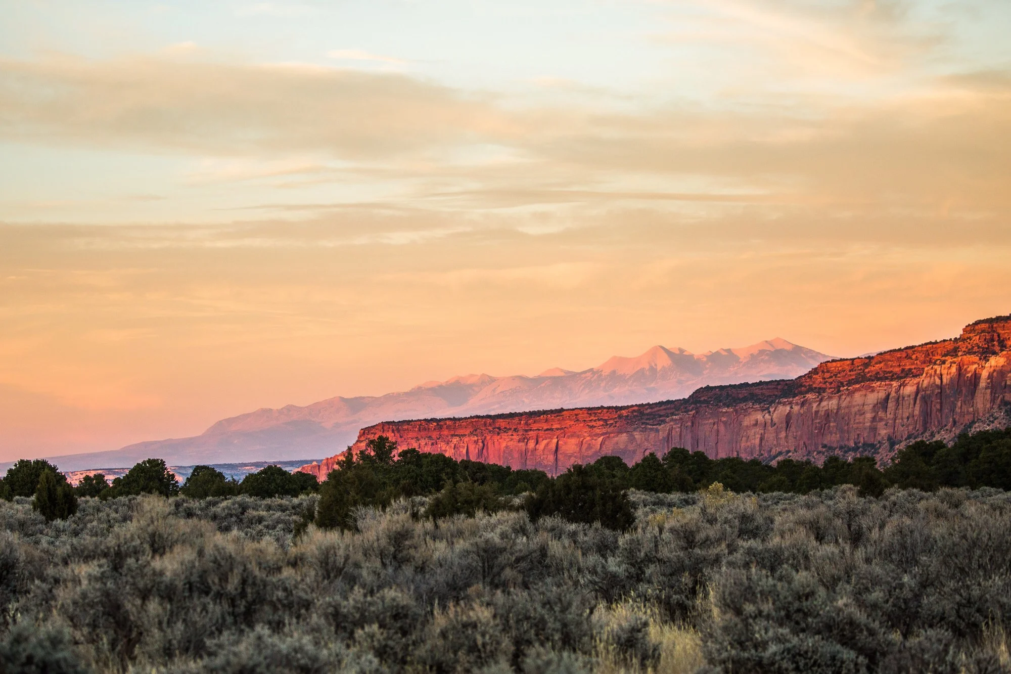
With the sun still burning bright in the late afternoon, the landscape around us surprised us with its beauty and quietude.
Then, with the afternoon and the approaching sunset, we decided to go on a 7 mile in-and-out hike to the dunes of the plateau, above the White Bluffs. As we slowly made our way up from the river to the top, through bright yellow grasslands and along the footprints of dozens of coyotes, we got to witness the stunning, hidden beauty of this place. Rising above the Columbia, the cliffs are about as impressive as the ones of the Upper Missouri. The river’s islands within sight are harboring large groups of ducks and gulls, while along the banks wetlands formed, colored by bright purple flowers. An hour into the slow hike we found ourselves standing in front of massive sand dunes. In the sunset light this was one of the most beautiful landscapes we’ve seen so far - the hidden treasure of Hanford Reach. The nuclear reactors, the agricultural lands, the power lines, all seemed tiny and insignificant from up there on the dunes. A sea of yellow and green grasslands and sagebrush hid a remarkable biodiversity. The Hanford Reach National Monument is considered safe for now as far as the presidential review goes, having been removed from the list even before Secretary Zinke's final report in September.
We loved it because it defies our standards of beauty which define what we consider important to protect. It’s also the testimony of the resilience of nature on a 196,000 acres piece of land, surrounded by ecological disaster and extensive agriculture. It’s an important place to learn to love and appreciate now, because when its role as a buffer zone is no longer needed, once the Hanford site will be considered safe, then the talks about its destiny as farmland could be reopened.

Commanding views of the last remaining free-flow portion of the Columbia river, the White Bluffs formations and the Saddle Mountain Wildlife Refuge make of this national monument a true hidden gem.

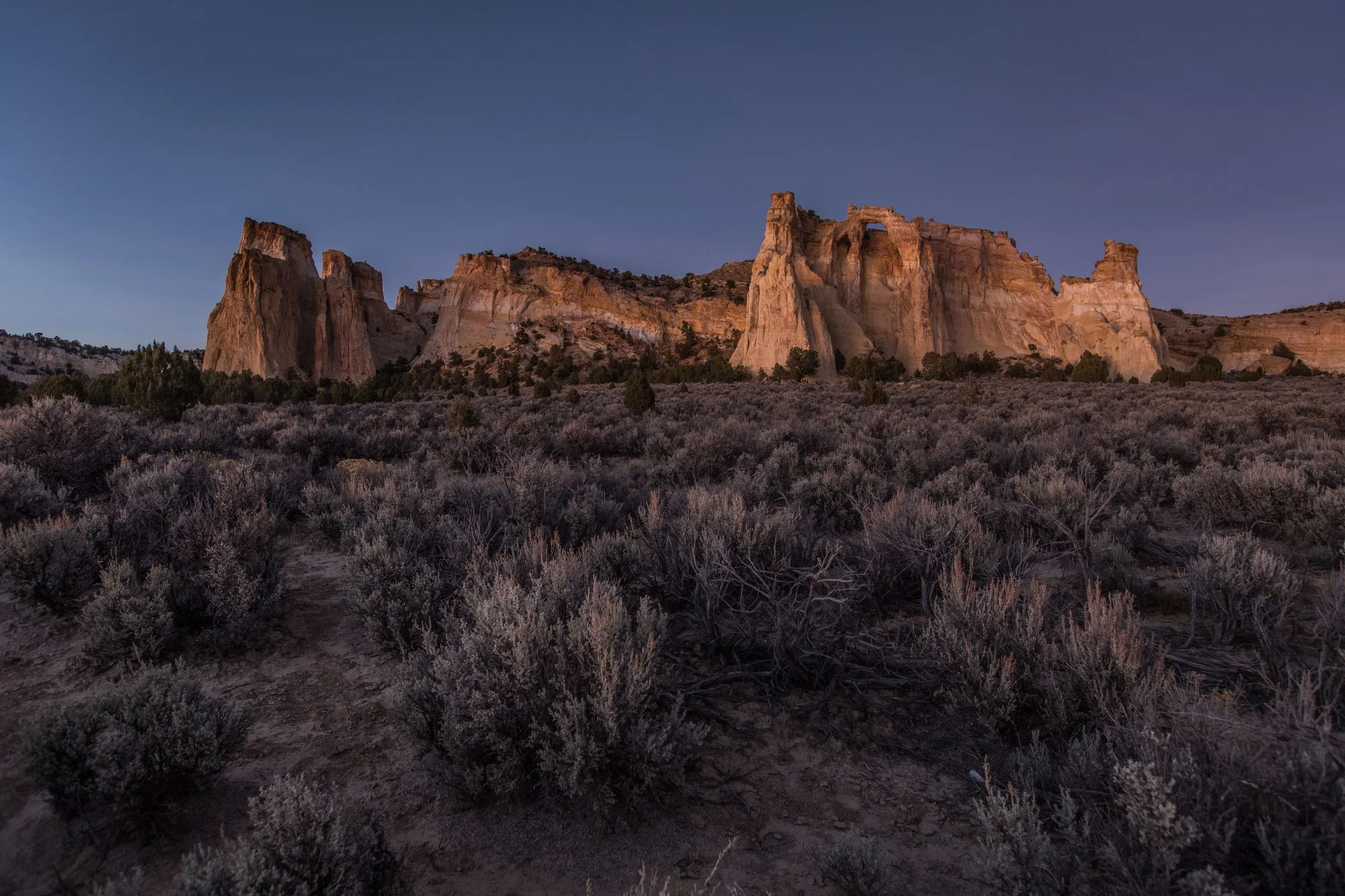
Reaching the first sand dune, we arrived to a breathtaking sight.

Pygmy Short-horned Lizard (Phrynosoma douglasii)
After sunset, we started noticing much more movement at our feet and all around us. Coyotes could be heard in the distance, while dozens of lizards started moving in the brush vegetation. This pygmy short-horned lizard greeted us on the trail and didn't run for cover, which gave Justin the opportunity to snap a portrait.


To date, President Joe Biden has designated five national monuments since coming to office in 2021. Here we take a look at four of those five national monuments that had a land conservation element, and what might be on the slate before the end of his first term.