PATIENCE IN KARUKINKA: Photos of a Conservation Project
Text: Andreea Lotak; Photos: Justin & Andreea Lotak · 7 min read

On day one on the Paciencia trail we got hit with so much rain that we had to consider the possibility of turning back around the next day. In Spanish “paciencia” means patience. As we would learn, this trail would require a lot of it: patience and hope to see the sun shining right when we needed it, patience with the mud and the ups and downs to get to amazing views, patience to observe the incredible ecosystems we were crossing. It was a first taste of Tierra del Fuego. If Patagonia itself is a challenge, its southern regions raise the bar even higher. And with that come incredible rewards.
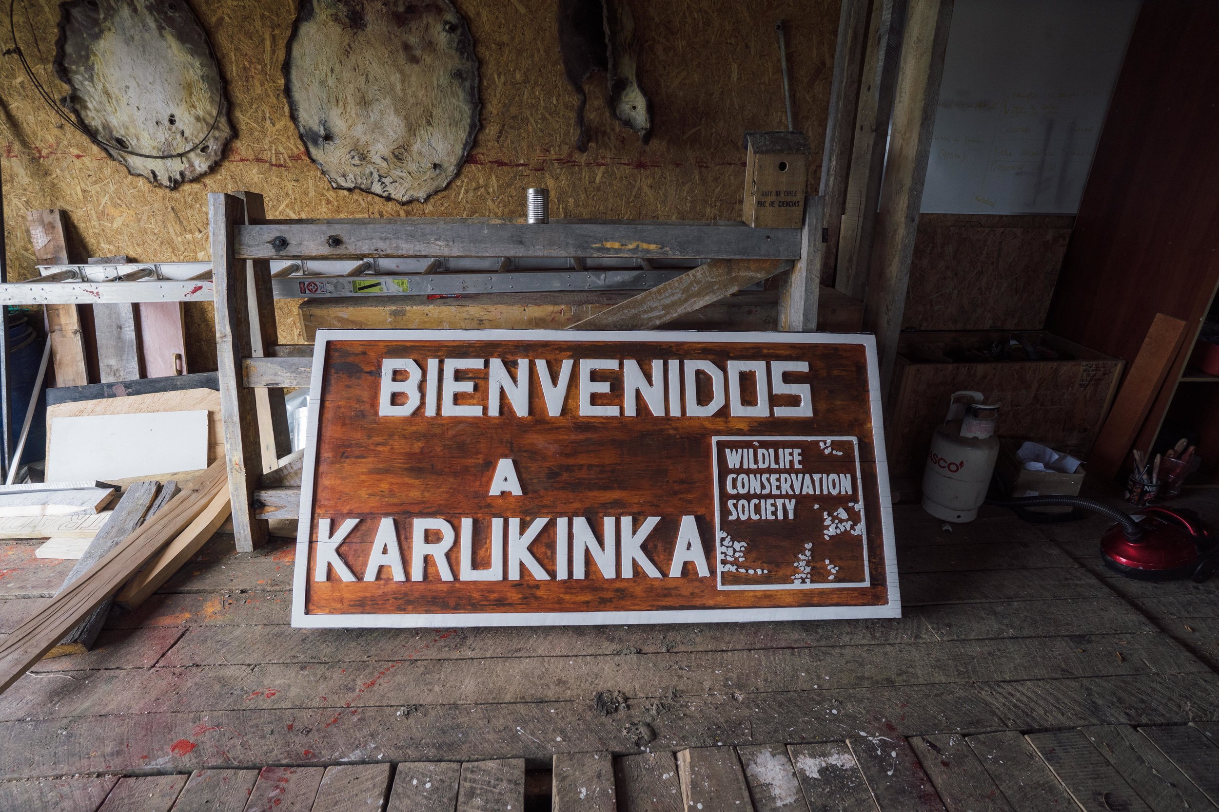
We made plans on how to get to this remote land from the moment we arrived in Punta Arenas, with help from great friends in a city that has become another “home away from home” for us. With bags ready we headed out in the back of Carolina’s car, with Daslav at the wheel and with the endless landscape of the Patagonian steppe rushing by. Once crossing the strait into Tierra del Fuego, one of the striking realizations was that there were no power lines or electricity poles scarring the landscape. It’s so vast and quiet, with one giant ranch from time to time breaking the linearity of the steppe. Thinking of screaming in a place like this would probably feel like one of those dreams in which you try to but no sound comes out. Nobody would hear you for miles, so it would be a pointless effort. This thought is both slightly eerie and uncomfortable, but also wonderful for the same reasons. Tierra del Fuego is still one of those “frontier” places, conquered only marginally by urban developments, but where large scale exploitation is, however, leaving its marks. After many hours through these dreamy lands on gravel roads, we entered the rangers’ headquarters and visitor facilities in Vicuña. We had arrived at the Karukinka Natural Park, a spectacular project of the Chilean chapter of the Wildlife Conservation Society (WCS).
Another 30 minutes driving south got us to the trailhead of La Paciencia. That was the gate into a world of incredible ecosystems. The story of the land within the park’s boundaries is a story of hope and conservation success. Destined to exploitation by a giant logging operation, and with a previous background of sheep and cattle grazing, it is now recovering through the efforts of the WCS. It is open to the public, mostly with a scientific and educational purpose, but also receiving a few hundred visitors annually. Most of the people we encountered on the trail were coming from the capital, Santiago. There were maybe ten in total throughout the six days we spent hiking, which, according to the rangers, is one of the busiest times the park has seen as far as visitation goes.
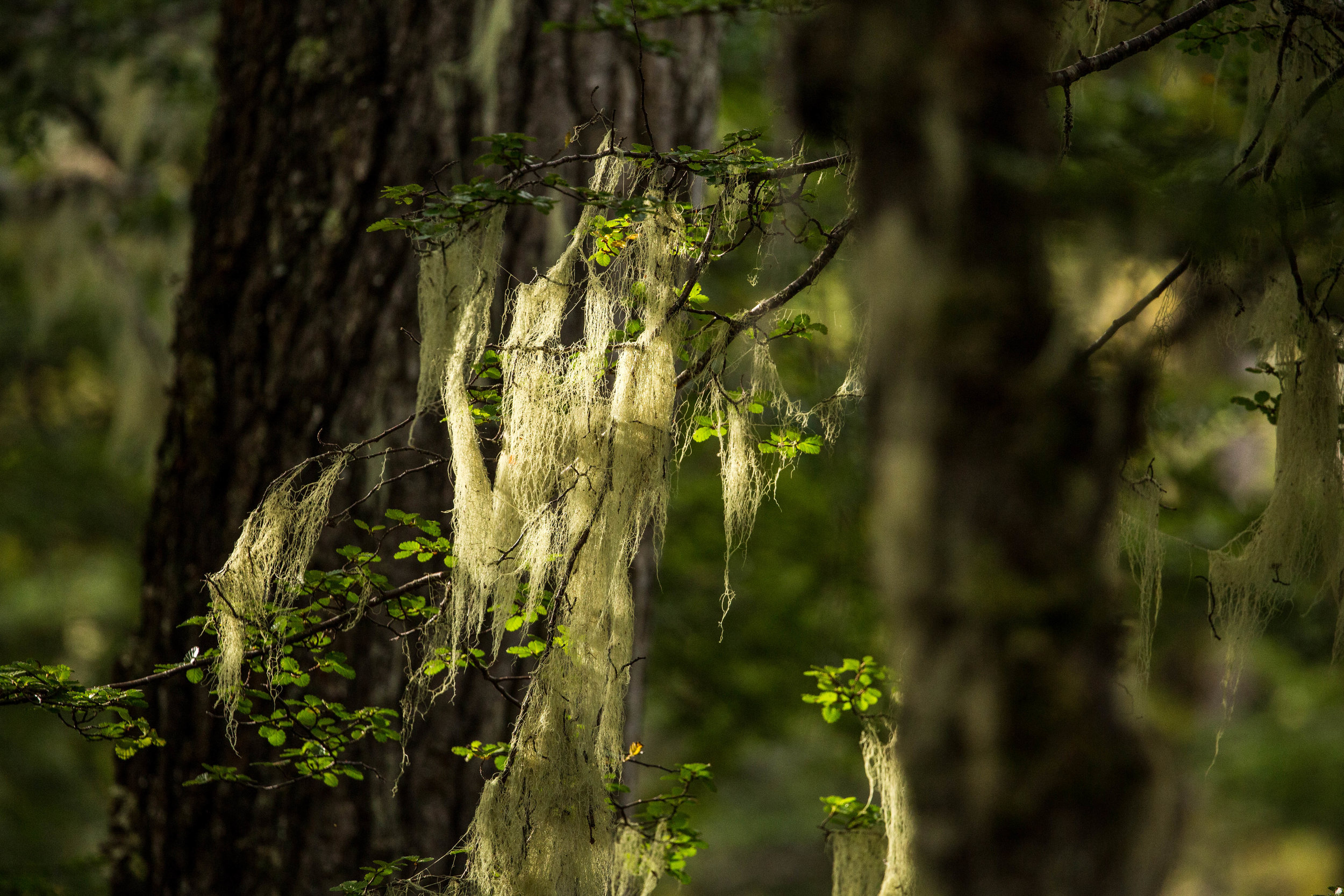
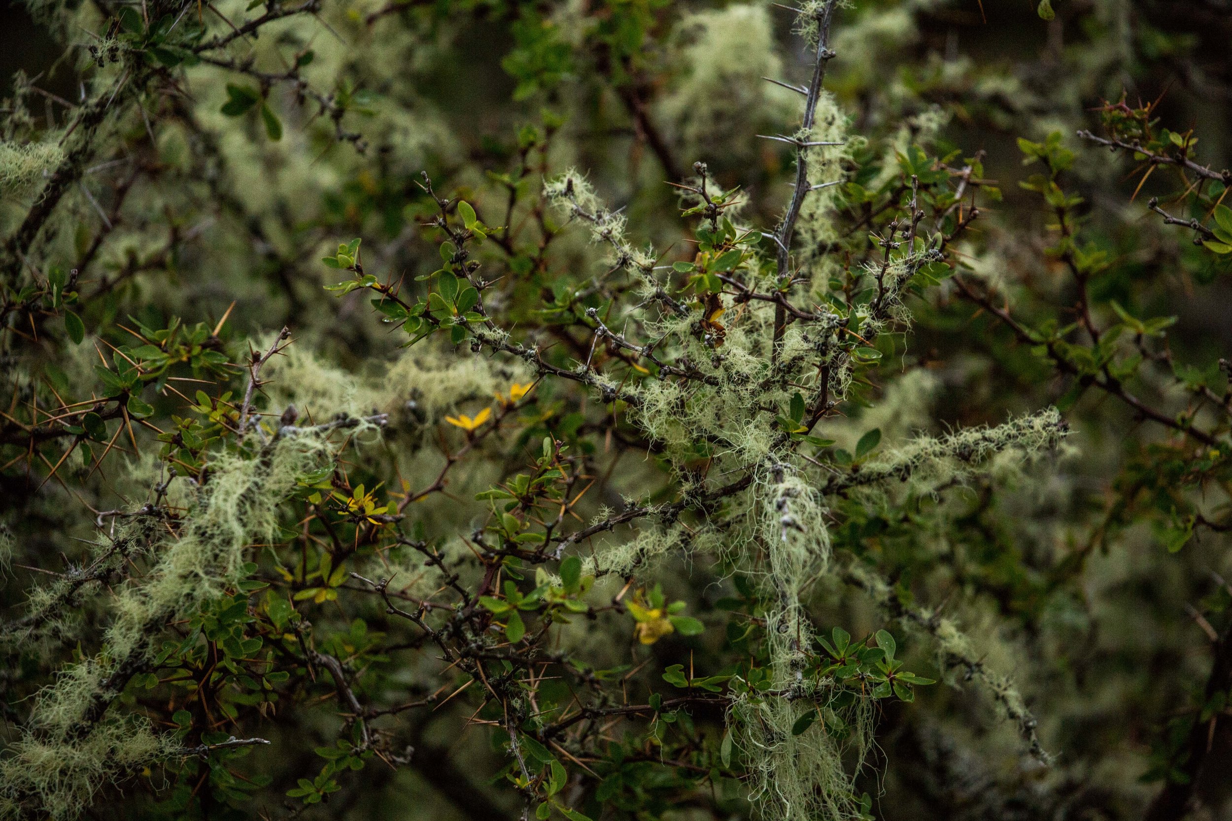
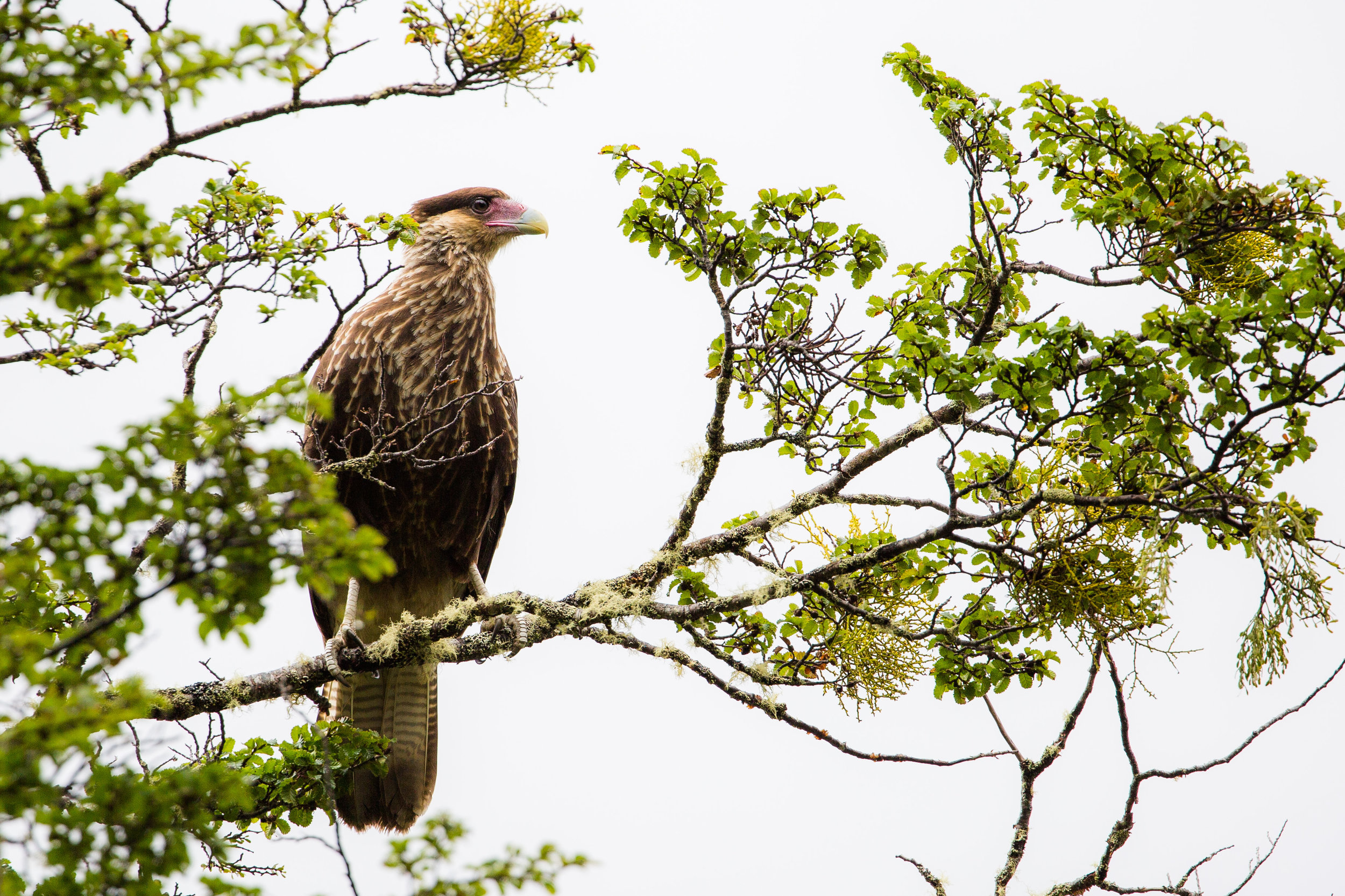
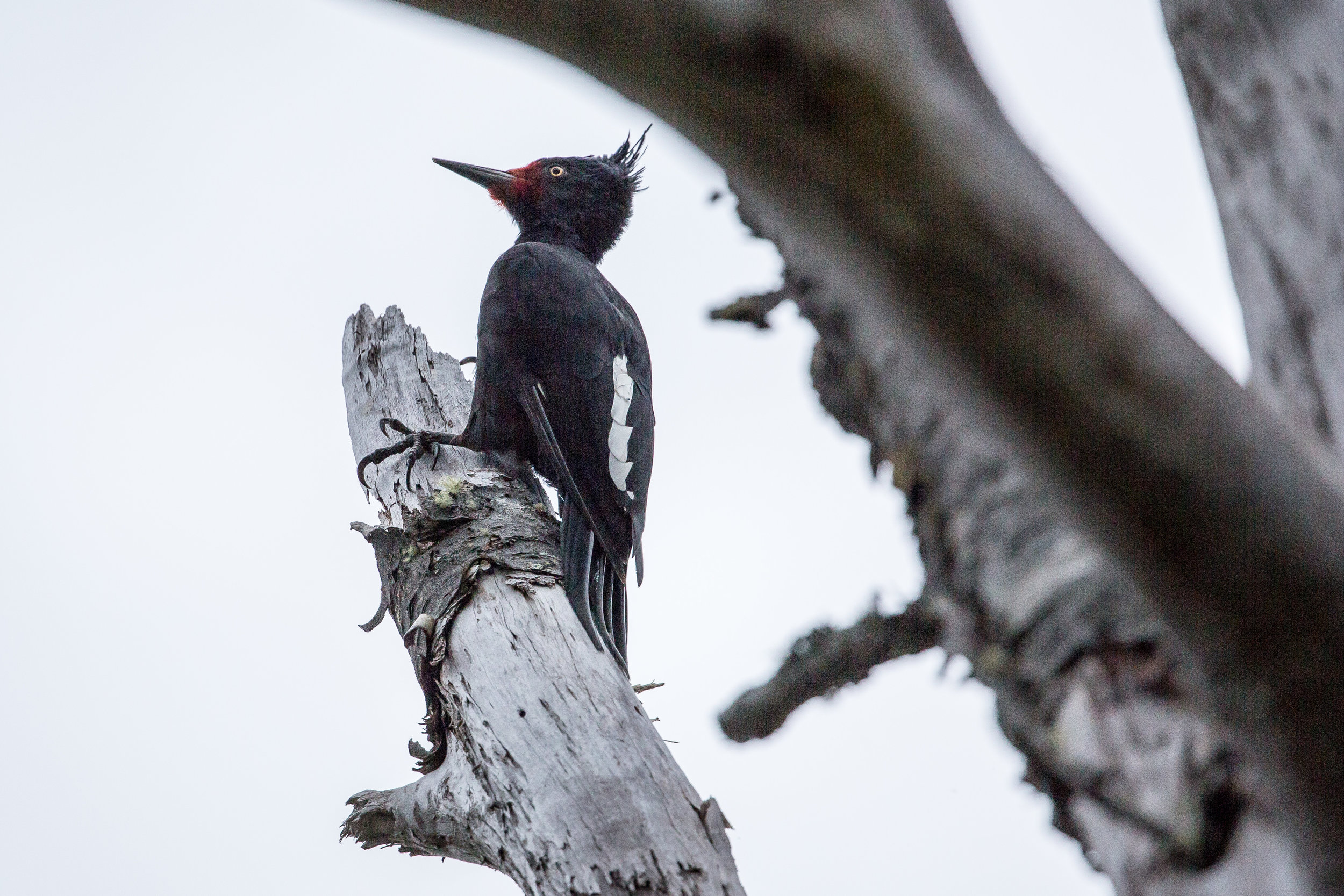
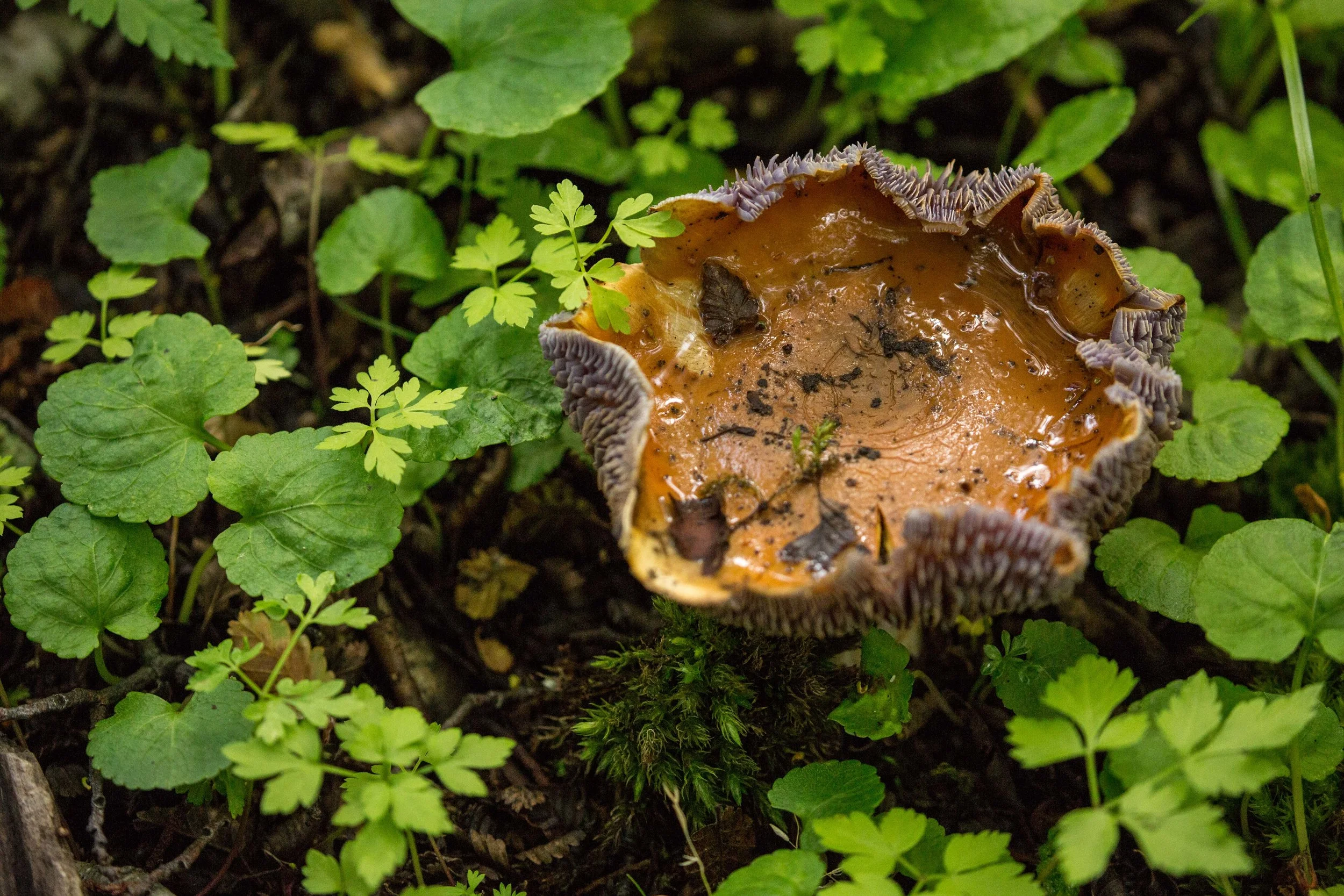
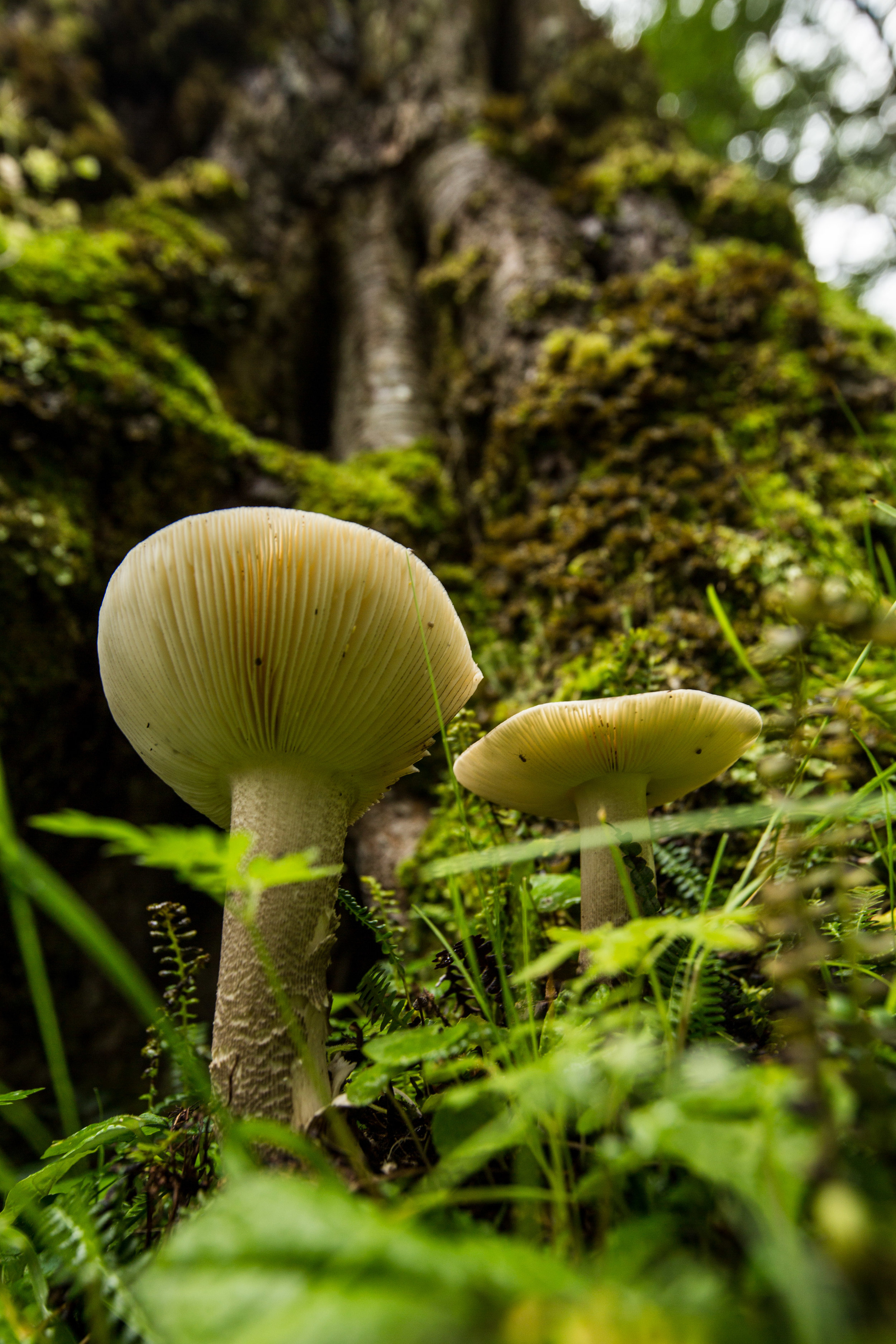
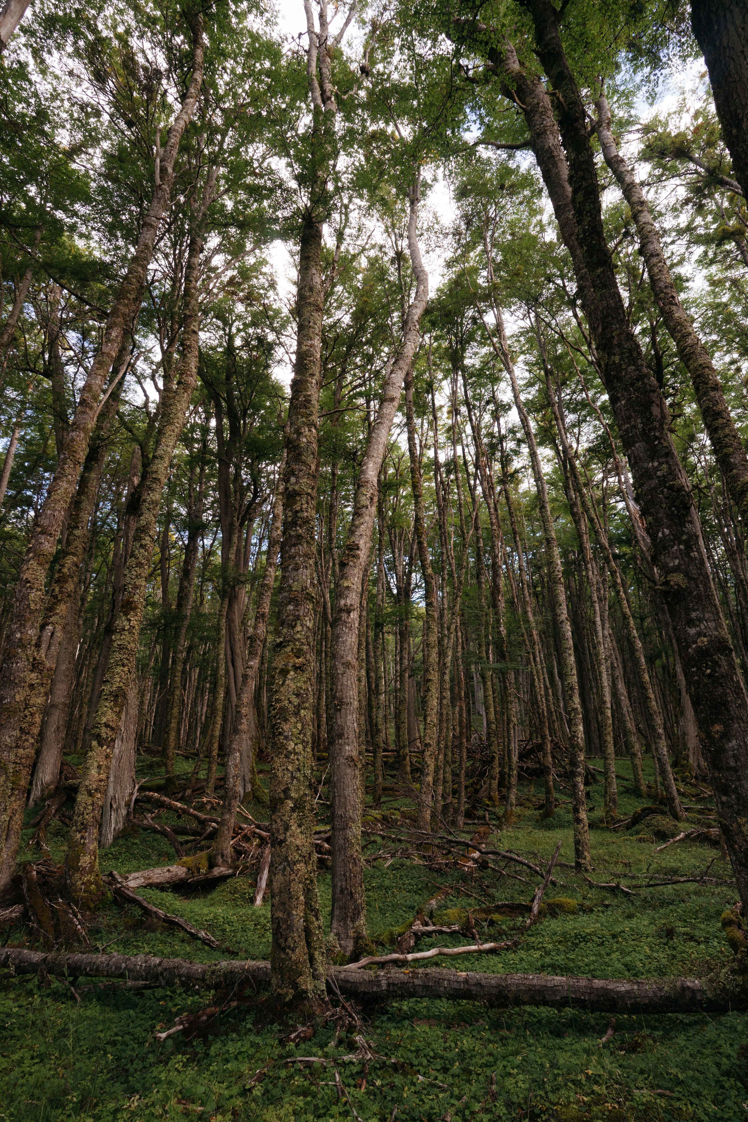
On day one we walked along the Despreciado lake, entered the lush old-growth forests of a surreal green, ran into a culpeo fox on the trail, and crossed a complex network of beaver dams. All the while, a tireless rain got the best of us. The next morning, when our hopes were low, Tierra del Fuego gave us a most amazing gift: the sun started shining and didn’t go away for hours. With everything dried we now had the enthusiasm to keep going all the way to the coast and back, completing the approximately 66 km of the trek. This cross between heavy clouds filled with rain and the occasional sunshine defined our entire experience. The beauty of the landscape and the abundance of the flora and fauna rewarded every ounce of patience spent sliding down the mud, falling into rivers or crawling under fallen trees. The valleys surrounded by mountains with snowy peaks, the vast peat bogs, and the change of landscape on the coast where the silhouette of the Darwin range was flanking the fiord, all made for this natural park to be a place of continuous marvel. The rain that fell also brought to life some of the most spectacular residents: mushrooms of all colors and sizes, bright fungi and lush gardens of mosses. The story in photos below probably does more justice to what we saw than any words can. One thing is important to acknowledge: the gratitude for the conservation of such a place through the determination of some of the local community, the vision of an unexpected donor and the efforts of the WCS. The forests, the peat bogs, the mountaintops and all the biodiversity residing in these ecosystems now have a sanctuary, where the occasional wanderer can get immersed into nature and get inspired.
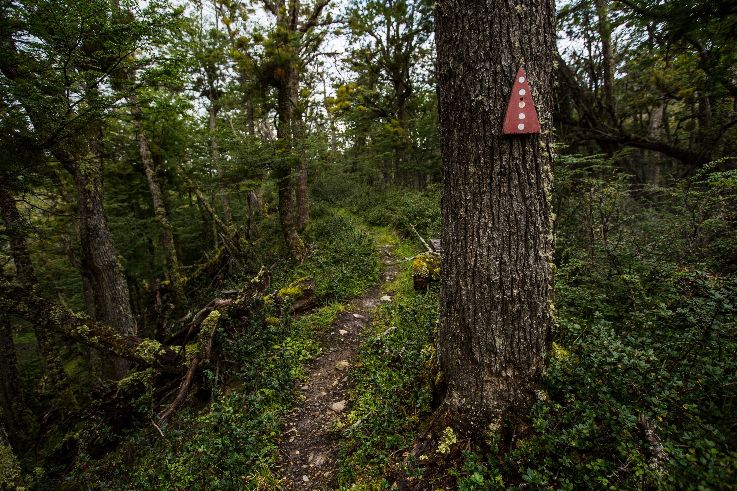
Paciencia trail
One of the trail markers of the Paciencia trail. It uses the colors and symbols of the Selk'nam people who lived in the area. The name Karukinka is of Selk'nam origin as well, meaning "our land". The rain that falls so often in the park has made the forest overwhelmingly green.


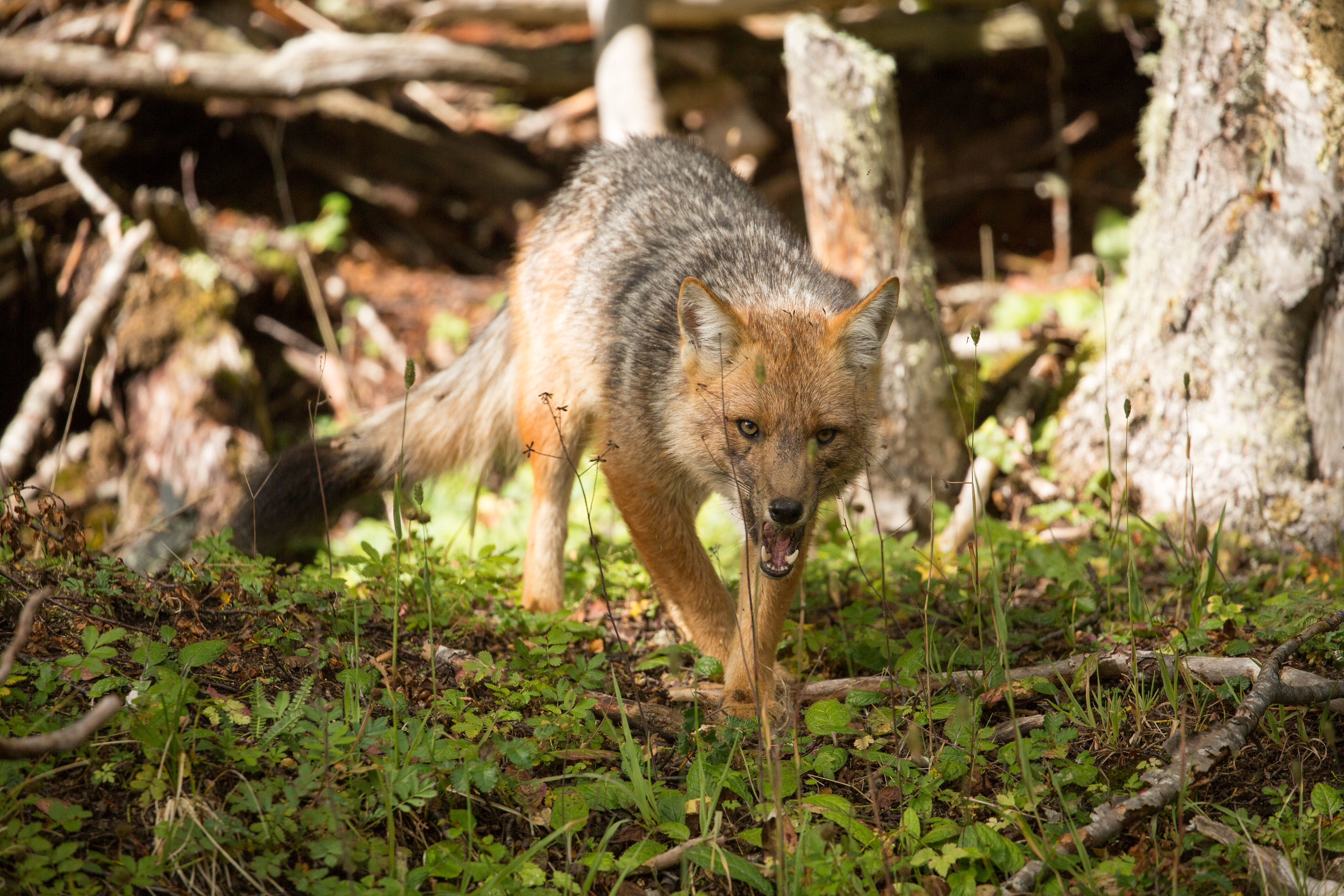
culpeo fox (Lycalopex culpaeus)
A culpeo fox once it finished scavenging for the bones of a dead guanaco. The forests of the Karukinka Natural Park are home to an important population in the area, offering a sanctuary to this second largest native canid species in South America.


Paciencia Bay
Reaching the end of the trail we arrived at the Paciencia Bay where the landscape changed entirely. Though the clouds covered up the Darwin range in front of us, there were moments where their silhouette showed up. Here there used to be a small logging and farming operation and what's left of the old house offered us a good refuge from the rain. The cattle that was abandoned here long time ago has now become wild and the cries of massive bulls known as baguales can be heard from miles away.
If you're looking to visit you can plan your visit based on information provided by the WCS website here or can check out our description of the Paciencia hike here. If you want to know more in depth the story of the park, its conservation challenges and vision, you can read here the interview with the Coordinator for the region of Magallanes of the WCS Chile, Daniela Droguett.


On a land destined to be logged, some of the most pristine valdivian temperate forests are now protected by this Nature Conservancy reserve. With its rugged coasts, ancient trees, impressive sand dunes, and local culture, it is a beautiful place to explore. Interview with Liliana Pezoa, administrator of the reserve.