NATIONAL MONUMENTS: Ten Essential Facts & Photographs
Text: Andreea Lotak; Photos: Justin & Andreea Lotak · 8 min read
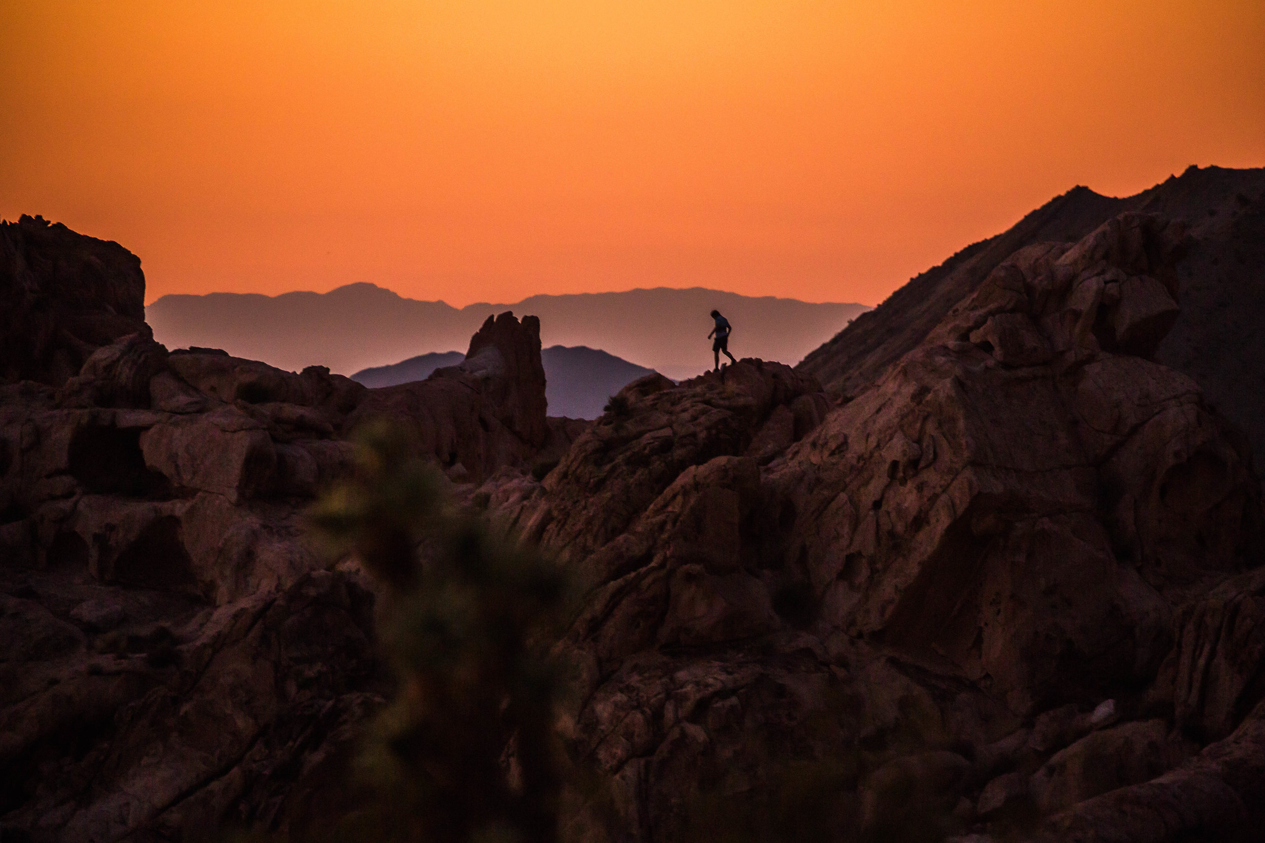
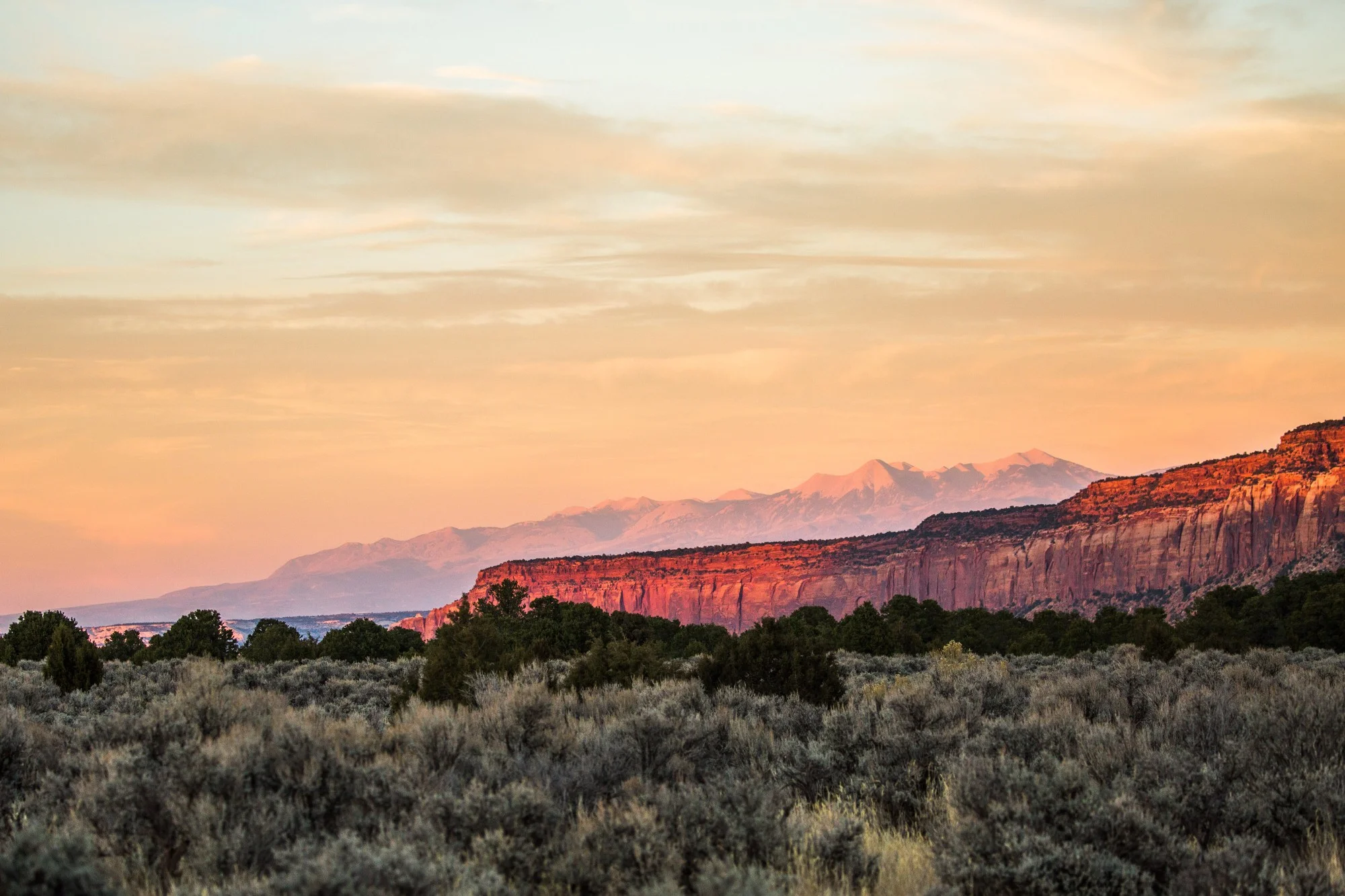
Gold Butte National Monument, NV
This is one of the four terrestrial national monuments that are listed to be shrunk in size as a result of the review performed by Secretary of Interior Zinke. The part that local organizations are afraid could be excluded is the one that protects a unique relict forest ecosystem that has been around since the last Ice Age. The monument is also protecting 12,000 years of human habitation that have left behind hundreds of petroglyphs, abandoned mines, and historic ranches, all surrounded by some truly incredible geologic formations.
For the past three months we’ve been traveling to twenty national monuments out West, which were included on Secretary Zinke and President Trump’s review list. These protected public lands harbor outstanding biodiversity, historic sites, scientific research opportunities and wild, rugged landscapes. Many of them hold a sacred importance for Native tribes. The majority of these western monuments are managed by the Bureau of Land Management (BLM) and by the US Forest Service. Below we share a few of the lessons we’ve learned and some of the photographs we’ve taken along the way.
#1:
National monuments can be created by Congress or by the President. The latter is possible through the Antiquities Act of 1906. Teddy Roosevelt used it for the first time to designate the Devil’s Tower National Monument in WY, on ~1,200 acres. In 1908 he designated the Grand Canyon National Monument, at over 800,000 acres. At the time, mining interests sued the decision and talked about this conservation land in terms of it being a disaster for the economy. In 2016 the Grand Canyon National Park brought over US $900 million to the local economy, and Arizona’s slogan is now “The Grand Canyon State”.

Left: Ironwood Forest National Monument, AZ. Saguaro cacti at sunset. Right: Sonoran Desert National Monument, AZ: A red-tailed hawk welcomes us on top of a saguaro at the entrance in the national monument. Both monuments protect some of the best preserved portions of the Sonoran Desert ecosystem and are located wihin an hour drive from cities like Phoenix and Tucson.
#2:
Thirty-two national parks were initially national monuments, including Zion, Arches, Joshua Tree, and Olympic. In 2016 these 32 parks brought over $3.6 billion in consumer spending to local economies. In 2014 visitors spent $2.8 billion on non-motorized recreation on BLM lands. All in all, the outdoor industry and recreation made up for almost $900 billion in consumer spending in 2016, the fourth largest category of consumer spending in the US. This led to the REC Act, which requires that in the following years this segment of the economy be calculated separately in the country’s GDP.

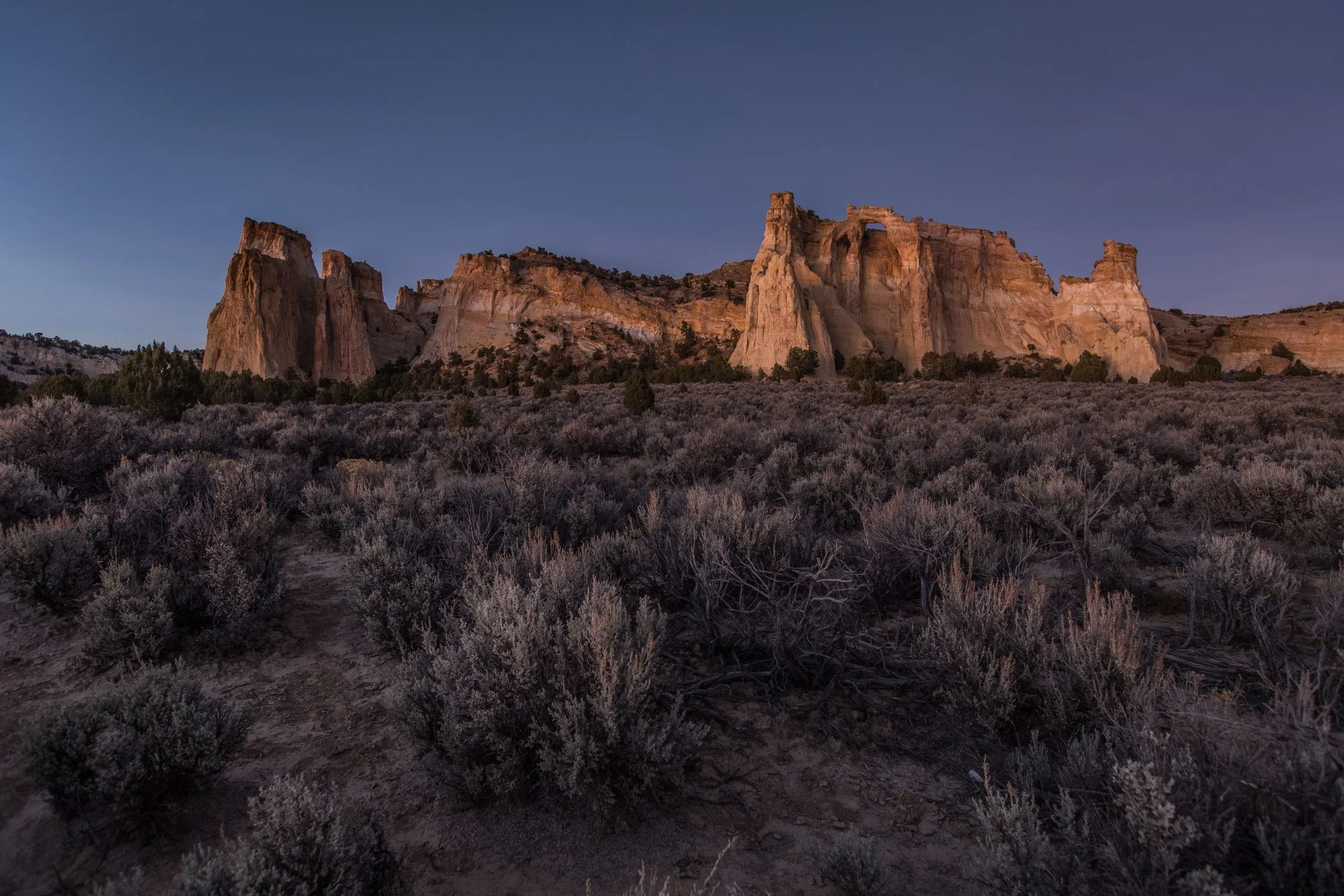
Grand Staircase-Escalante National Monument, UT
Following the review, it was recommended that this monument be significantly reduced in size from its current 1.9 million acres. Although not popular among many residents and politicians when it was created in 1996, it has now become a real driver for the economies of nearby towns like Kanab and Esclanate. The Kaiparowits and Wahweap formations are the sites of the most exciting discoveries in paleontolgy: some 20 new dinosaur species were discovered here since the monument was created. Fossil fuel resources also present in these areas have driven politicians, both locally and nationally, to push for mining and to ignore the sustainable economy that has flourished around the monument.
#3:
There are 129 national monuments currently, the majority being managed by the National Park Service (NPS). The BLM has become much more involved in conservation management since 2009, when the National Conservation Lands system was officially created.

Berryessa Snow Mountain National Monument, CA
The Homestead-Blue Ridge loop hike in Berryessa Snow Mountain National Monument. At the southern tip of this national monument, UC Davis is doing research to better understand the effects of today’s wildfires that have become much more destructive. Since this ridge was burned down in 2015, the vegetation has started coming back, and we were able to witness a regenerating ecosystem of stunning beauty. The monument itself stretches along seven counties north of San Francisco, with a significant portion of it located within the Mendocino National Forest. Right: Northern Pacific rattlesnake.
#4:
The BLM manages a total of almost 245 million acres in the West. Grazing is permitted on 155 million acres of BLM public lands, plus on around 100 million acres of Forest Service lands out west. In addition, ranchers in the West own almost 120 million acres of private lands. National Conservation Lands, which include wilderness areas, wild & scenic designations and national monuments cover over 30 million acres. The 27 national monuments managed by the BLM total 11 million acres. Some of the ranchers are, unfortunately, among the more vocal opposition to national monuments. They see them as “land grabs”, despite the fact that monuments take up a relatively small amount of land compared to the total.

Left: Coyote in Basin and Range National Monument, NV. This monument is protecting a few of Nevada’s last wild valley ecosystems — or basins — in a setting that is truly beautiful and vast. Right: A dreamy-looking tarantula in Carrizo Plain National Monument, CA. California’s largest intact grasslands are protected within the boundaries of this monument, crossed by the San Andreas Fault. In springtime, if the conditions are right, it becomes the site of one of the most impressive ‘super blooms’ — an explosion of wildflowers — in the world.
#5:
On April 26, 2017, President Trump signed an executive order to review national monuments created through the Antiquities Act since 1996. The reason is to evaluate whether presidents abused their power to create these monuments, whether the public was consulted, if other land uses like mining or logging are better for those lands, and whether they “curtail economic growth”. A study by Headwaters Economics in 2017 proved that the economies of counties that have national monuments within their boundaries have continued to grow, in some cases faster than the state’s average. Of the twenty national monuments we visited, the majority had grassroots efforts going for many years before the protected designation happened. The public is consulted before designation and many local stakeholders are involved in creating the management plan of each national monument.

Left: A tiny but brave round-tailed horned lizard standing up to us in the Organ Mountains-Desert Peaks National Monument, NM. The monument surrounds the City of Las Cruces and hosts an incredible diversity of plant life, lizards, mammals and insects. It’s also a place where millenary native history converges with the Camino Real, stagecoach routes, WWII practice targets, and Apollo missions training grounds. Right: An Anasazi skipper, a butterfly subspecies which appears to be endemic to the Rio Grande gorge within the Rio Grande National Monument, NM. The Rio Grande is New Mexico’s largest river and its life line. Wildlife and plants depend upon this river, the nation’s most exploited. In the monument the landscape remains wild still, after millennia of habitation by Native tribes and centuries of responsible cattle grazing by hispanic ranchers.
#6:
National monuments managed by the BLM and the US Forest Service are wilder and with less infrastructure than NPS lands. This offers visitors a different, more remote experience, which requires more responsibility and independece. Monuments also allow multiple use. Almost all of them include existing rights for grazing, mining, or logging. Hunting, fishing and OHV activities are allowed in designated areas. Private property rights and public access are guaranteed by the proclamation and the management plan.

Left: Cascade — Siskiyou National Monument, OR. This is the first and only national monument protected solely for its unique biodiversity. Located at the convergence of three distinct mountain ranges and hosting one of the most special ecosystems in the country, it should not be on the list of monuments to be reduced in size. Right: Giant Sequoia National Monument, CA. If you’re looking to be reminded of gratitude for living on planet Earth, a visit to this national monument will fill you up with a sense of awe that will take you back to your childhood days.
#7:
The Antiquities Act has a stipulation for creating a national monument: “the limits of which in all cases shall be confined to the smallest area compatible with the proper care and management of the objects to be protected.” Secretary Zinke and others are using this clause to state that national monuments are not meant to be big. However, in many cases “the smallest area compatible with the proper care and management of the objects to be protected” isn’t small. In the case of Cascade-Siskiyou over 200 scientists have signed a letter explaining the reasons why the monument should, in fact, be expanded further, as the current boundaries aren’t compatible with the minimal area needed to conserve its complex ecology and biodiversity — the objects protected by the monument.
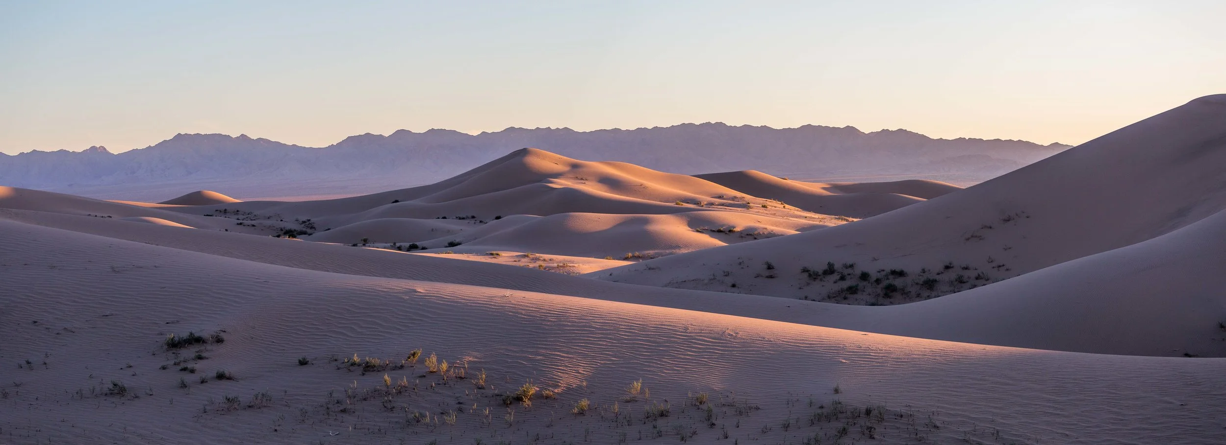
Mojave Trails National Monument, CA. At the heart of this monument lies the largest conservation land donation in the US history — over 500,000 acres were acquired in the late 90s by The Wildlands Conservancy and other partners, and donated to protect the California desert. In 2016 the national monument was created, covering 1.6 million acres of otherworldly landscapes, historic trails of Native tribes and one of the best preserved portions of Route 66. It’s also an important connection between other conservation lands, like the Joshua Tree National Park and the Mojave National Preserve. Pictured here is the landscape of the Cadiz Dunes Wilderness within the monument.
#8:
In May 2017 the Department of Interior (DOI) announced the opening of a public comment period regarding the review of the 27 national monuments. They allocated only a 15-day period for comments regarding Bears Ears, and 60 days for the rest of the monuments. The Center for Western Priorities looked at over 650,000 of the over 2.5 million comments received by the DOI and concluded that roughly 98% were in favor of Bears Ears and other national monuments.

Upper Missouri River Breaks National Monument, MT
Prairie dogs in Upper Missouri River Breaks National Monument. The Missouri river is the longest in the country, at 2,341 miles. The monument protects a stretch of over 100 miles, as well as the lands surrounding the river. Floating down the Missouri between the various landing points is an experience similar to a trip back in time, where the silence of the landscape is broken only by the sound of your paddles brushing the water.
#9:
Utah is home to both Grand Staircase-Escalante and Bears Ears national monuments, the two that are most at risk of seeing significant size reductions. The Bears Ears region was declared an “Energy Zone” by the Utah State Legislature a year before the monument was created, while Grand Staircase-Escalante has significant underground resources of coal, oil and minerals. However, in 2016 tourism in Utah brought $8.4 billion in visitor spending, contributing $1.23 billion in state and local tax revenue. The most recent report found for the energy industry from 2015 shows that it brought $655 million in taxes and fees to the state of Utah (over 90% of the energy production comes from non-renewable sources). There are 144,000 jobs supported by the tourism industry, and almost 40,000 by the energy sector. Both monuments were described as disasters for the economy by opposition. Both Kane and Garfield counties, where Grand Staircase-Escalante is located, now stand in the top ten counties ranked by per capita income in Utah. San Juan county, where Bears Ears was recently created and where oil and coal have been extensively developed for decades, takes the 29th position as Utah’s poorest.
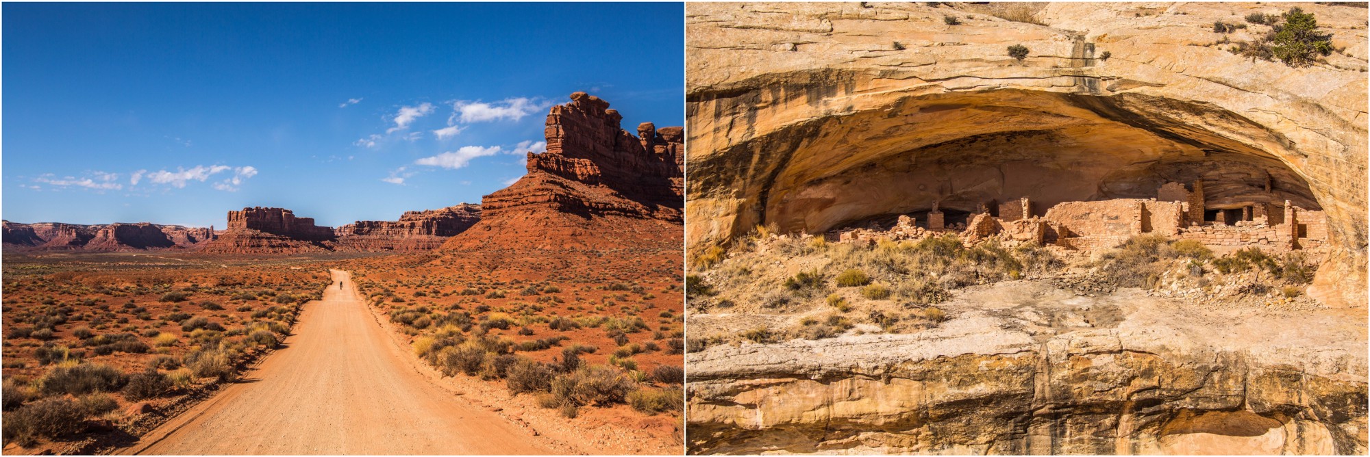

Bears Ears National Monument, UT
The poster child for this presidential review of 27 national monuments, Bears Ears represents a historic moment for five Native tribes, who have come together for the first time to drive the creation of a conservation area. Among the outstanding beauty of canyons, rock walls, rivers and wild forests, there are over 50,000 archaeological sites bearing a cultural and religious importance for several tribes. Based on signs from the presidential administration and from the fierce opposition of Utah politicians like Orrin Hatch and Rob Bishop, it is feared that the monument will be rescinded. Although Secretary Zinke recommends protections for some of the sites, it will create a fragmented landscape of unconnected lands, which ignores the official stance of all tribal leadership from this region.
#10:
This past September the memorandum that Secretary Zinke sent to the White House after completing the review leaked to the Washington Post. It revealed recommendations to change management plans of ten national monuments to include “traditional land use”, like grazing or mining (which for the most part are permitted already). Four terrestrial national monuments have been targeted for a size reduction: Cascade-Siskiyou in Oregon, Gold Butte in Nevada, Bears Ears in Utah and Grand Staircase-Escalante also in Utah. President Trump manifested special interest in reducing the size of the two latter ones, as he is preparing for a visit in Utah this December. Two marine national monuments have also been recommended for boundary reductions: Rose Atoll and Pacific Remote Islands.


To date, President Joe Biden has designated five national monuments since coming to office in 2021. Here we take a look at four of those five national monuments that had a land conservation element, and what might be on the slate before the end of his first term.