THE WILDLANDS CONSERVANCY: Private Initiatives in the Sand to Snow & Mojave Trails National Monuments
Text: Andreea Lotak; Photos: Justin & Andreea Lotak · 10 min read

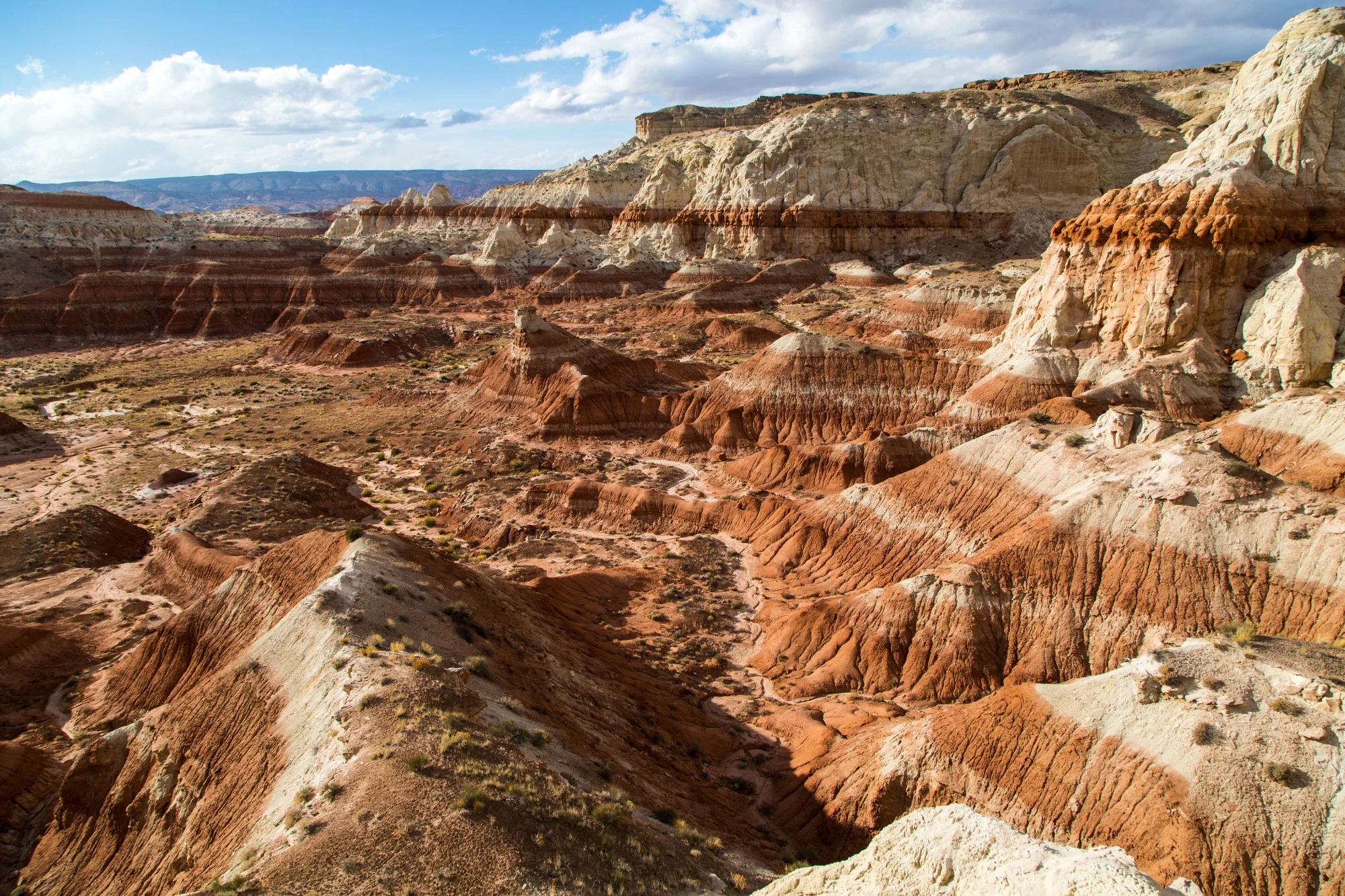
Whitewater River
When we think of southern and coastal California, what comes to mind first is the urban sprawl of the cities and towns where people have been continuously piling up in the past decades. In a place crowded with human development, the vast, open spaces of the wilderness have an even deeper significance and value. They are the second home that receives the hundreds of thousands of residents seeking solitude and grasping for the clean, crisp air of the alpine forests or of the high desert.
The Mojave Desert, with its apparent harsh environment, kept large-scale developments at bay for many decades following the arrival of the new settlers. In the 1930s, people like Minerva Hoyt, started recognizing that the desert ecosystem has many beautiful lessons to teach us and that its fragility was threatened. In 1936, through her efforts, president Franklin D. Roosevelt declared the Joshua Tree National Monument. Fifty-eight years later and through the work and vision of Sen. Dianne Feinstein (D-CA), the California Desert Protection Act passed, which turned the Joshua Tree and the Death Valley National Monuments into national parks, created the large Mojave National Preserve , 69 new wilderness areas, and doubled the size of the San Gorgonio Wilderness. The latter is now part of the new Sand to Snow National Monument. Working together with local activists, organizations, and diverse stakeholders, Dianne Feinstein also drew the borders of three new national monuments that would further protect the Mojave Desert ecosystem. After legislation stalled in Congress for many years, it was decided to appeal to President Obama to use his executive power and declare the monuments through the Antiquities Act. On February 12, 2016 three new national monuments were created: Castle Mountains, Sand to Snow and Mojave Trails. Mojave Trails, at almost 1.6 million acres, represents an instrumental protected area that connects other large conservation lands, giving plant and animal species a good chance to continue to thrive and evolve. The long-standing work to protect the Mojave Desert was concluded with the creation of one of the most successful large scale conservation models.

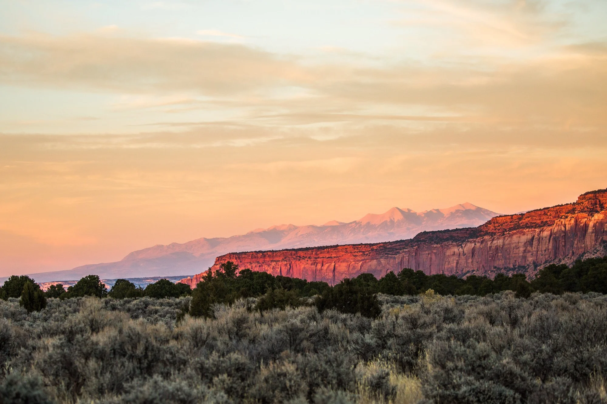
Sand to Snow National Monument, california
Taking pictures of the beautiful panoramic views of the San Bernardino Mountains

Whitewater River in the Sand to Snow National Monument
It can be accessed from the Whitewater Preserve and is also part of the San Gorgonio Wilderness.
The Wildlands Conservancy, “California’s largest nonprofit nature preserve system”, played a key role in the creation of the Sand to Snow and the Mojave Trails National Monuments. At their office in the Whitewater Preserve, surrounded by Sand to Snow, we met Jack Thompson, Regional Director of the desert preserves belonging to The Wildlands Conservancy. “The Sand to Snow National Monument expands the border of the San Gorgonio Wilderness to account for biological corridors. The more the conservation thinking evolves, the more important the idea of biological corridors becomes. Ultimately, it doesn't make a lot of sense to have a conservation area that’s surrounded by development, which then turns it into a sort of island where plant and animal species can't move around. Part of our goal was to see more lands protected in the long term surrounding already designated wilderness or conservation areas. So what the Whitewater Preserve truly accomplishes is to be strategically positioned to invite the public into the Sand to Snow National Monument. The preserve is located at the end of a county road and before, when it was a fish hatchery from the 1930s until the mid 2000s, when people came here they would find a “Private Property” sign which would turn them around. The Wildlands Conservancy worked with partners (The Coachella Valley Mountains Conservancy and Friends of the Desert Mountains) to acquire land to restore it and to facilitate public access. Our executive director talked about what we’re doing along these lines: ‘The boundaries that are around our national conservation lands are really kept in place by what’s in the hearts and minds of people’. If the boundaries don’t have people fighting to protect them, then they will eventually disappear. As we’re seeing now, with the Trump Administration’s review of certain National Monuments, it’s important to help people form a relationship with these lands. And for that they need access to them. People can come to this preserve where there’s no cost, they can obtain permits to park their vehicles overnight and go on backpacking trips in the monument, or camp for free. We also have education programs for kids, and it’s all in the spirit of the idea that the need to be in the wilderness is part of the human nature.”

Bobcat (Lynx rufus)
A female bobcat spotted at sunset in the Whitewater Preserve, gateway to the Sand to Snow National Monument

western fence lizards (Sceloporus occidentalis)
Two large male western fence lizards picking up a fight which took a pretty brutal turn. Whitewater Preserve, Sand to Snow
The Wildlands Conservancy manages three desert preserves that were strategically created as access points to wilderness where public access was previously restricted. Two have visitor centers, maps, interesting information regarding the ecosystems, and staff on site. We learn from Jack that as private landowners within or bordering the monument, The Wildlands Conservancy gets involved in the process of developing a management plan for Sand to Snow. This is the case for all landowners whose properties are surrounded by the national monument. “There is a certain amount of fear, I think, that goes into what can happen with private property within protected lands and there’s a lot of polarizing rhetoric that gets thrown around by a small minority of people, but they are still dwarfed by the large number of those who appreciate having access to a public land that’s protected. They understand that a national monument is a mechanism of protection for public lands that could otherwise be used consumptively by a small number of people. In our case we held public meetings, as is usually done when national monuments are close to being created, so that people can speak up to their elected officials. We held one here, at Whitewater Preserve, and 1000 people showed up. The public opinion was 4 to 1 in favor of Sand to Snow, Mojave Trails and Castle Mountains.”
While The Wildlands Conservancy continues to own and manage the preserves which represent important access points to the Sand to Snow National Monument, they donated over 500,000 acres to become public lands which were crucial for the creation of the Mojave Trails National Monument. “What ultimately led to The Wildlands Conservancy getting involved in the Mojave was that some of the lands that were set aside for conservation through the California Desert Protection Act of 1994 had a lot of private railroad inholdings within them. That was a legacy of land gifts from the federal government in the 1800s, during the western expansion. They wanted to have railroads to push west, and to give those companies incentives they came up with this system where for every mile that the railroad would push forward they would gift them every other square mile of land 25 mi north and 25 mi south of the rail line. So it ended up creating this 50 sq mile checkerboard that follows the rail line, where every other square mile is owned by the railroad companies. Those lands went along the Route 66 corridor, which from Ludlow to Needles represents one of most beautiful and best preserved sections of the road, with the pristine Mojave surrounding it. The railroad didn’t seem to be doing a lot with those lands, they were mostly just sitting there. Then, in the late 90s, the railroad companies started to look at selling them for development. When that happened it represented a huge threat for those public conservation lands surrounding areas like the Joshua Tree National Park. So our organization saw the threat and worked with Sen. Feinstein and with private donors to raise the funds to buy those lands and then donate them back to the Bureau of Land Management [BLM] and the National Park Service [NPS]. The Conservancy raised the money to buy 560,000 acres and then they donated all of it to these agencies. At the time it was considered the largest private conservation land donation in American history. It probably remains so until today.”
The donation stipulated restrictions for gas exploration and mineral extraction, but soon after they realized that with California’s acceleration of renewable energy production, the Mojave was facing the prospect of new large-scale development. Solar companies started petitioning the BLM for land leases for big projects. The same environmental organizations then got involved in helping regulate where these projects would get assigned so that they wouldn’t fragment the migration corridors and the connectivity among conservation lands. Ultimately, the best solution was seen in the idea of creating a national monument that would be the last piece of the puzzle which would protect one of California’s best preserved ecosystems. The current National Monuments review ordered by President Trump gave the 8th district Rep. Paul Cook, who has Mojave Trails under his jurisdiction, a new opportunity to challenge the national monument and recommend in a letter to Secretary Zinke that the Trump administration shrink Mojave Trails by roughly a third. This is where a water project managed by Cadiz Inc. would build a pipeline that would transport water from the desert aquifer to cities in southern California. Jack adds: “The Deputy Secretary of Interior was a lobbyist for that company until recently. David Bernhardt is his name. A lot of people feel like it’s no surprise that the area targeted by the review in Mojave Trails is the area that surrounds the water project. Bernhardt was a partner in a law firm that actually owns stock in Cadiz Inc. and worked as their lobbyist [the CEO of Cadiz Inc. is actually a shareholder in the firm]. Although Rep. Cook will say that it has nothing to do with Cadiz, none of us believe that.” So far, however, no changes have been recommended by Secretary Zinke for any of California’s monuments.
“THE BOUNDARIES OF OUR NATIONAL CONSERVATION LANDS ARE REALLY KEPT IN PLACE BY WHAT’S IN THE HEARTS AND MINDS OF PEOPLE”
With every interview that we did we got into the habit of asking what makes these places special, so that we can better understand why they are protected and why they should be visited and enjoyed consciously. Jack spoke with passion about both national monuments: “For Sand to Snow there are several things. There is an area that gets defined by a really high biodiversity in North America, called the South Coast Biological Region. It’s one of the top 25 most biologically diverse ecoregions on the planet. It goes all the way to the Channel Islands and spreads to the foothills east of the San Bernardino Mountains. This is where this coastal mountain range reaches the desert. Sand to Snow includes the confluence of the desert ecosystem reaching these transversal, east-west trending mountains. The highest altitude of the mountain range is the San Gorgonio Peak, which gets to 11,500 ft. On the eastern side of the range those slopes give way to the desert. In one trip you can be in an intersection between different desert ecoregions that are coming together, and then lead up into the mountainous, alpine regions that cover a relatively small geographical space. So there’s a large diversity of life here, a huge amount of endemic plant species. It’s also very close to big urban areas. I think that within a two-hour drive around it there are 18 million people living in urban environments. It’s the place that a lot of communities have for recreation. People come here to see bighorn sheep walking along the cliffs, a big diversity of birds coming to the canyon, deer, bears, bobcats; on a really rare occasion maybe they can spot a mountain lion. It’s the most biologically-diverse mountain range of its size in the United States.”
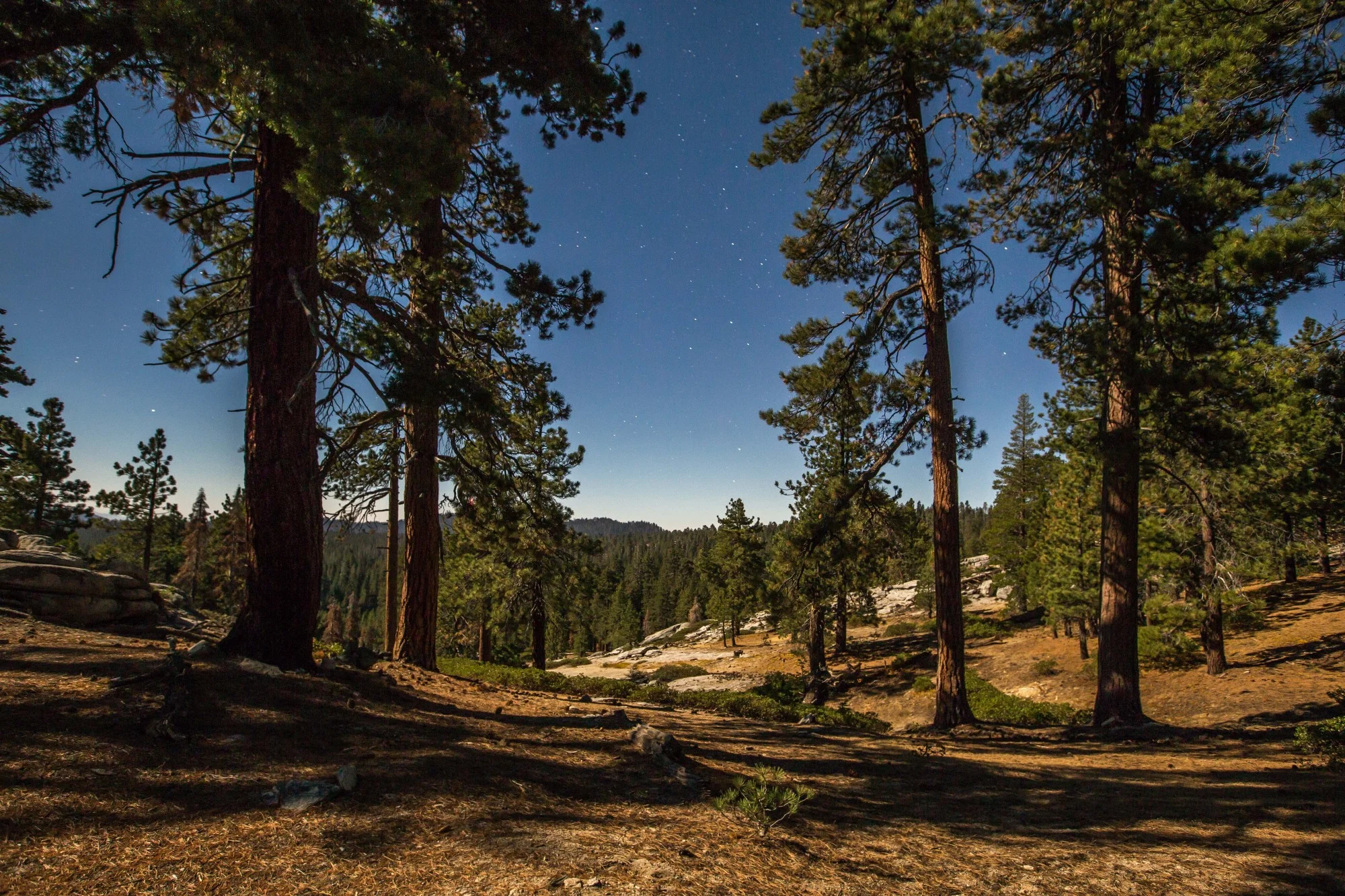
"As far as the Mojave goes, it contains one of the last pristine sections of Route 66 that’s written about in ‘The Grapes of Wrath’, where it’s called the Mother Road by those people escaping the Dust Bowl. It’s also sacred to Native Americans, and there are many of their trails going through the area. The Mojave tribe definitely has a strong connection with these lands and a strong heritage. It’s also vast, pristine desert. When you go there you see a whole collection of mountains looking very different from one another. There is a very different geology, so you see these contrasts everywhere you go. And it’s so underdeveloped. When you get there you just get this feeling of remoteness which is pretty rare in southern California - to be able to see for dozens of miles in any direction and not spot anything man-made. The night sky there is incredible; amazing dark, dark skies. Because there is a railroad going through the region there is a web of little dirt roads for utility corridors and they connect you to the different mountain ranges. You can pack a vehicle with supplies and a few maps and go get lost in the Mojave for as long as you can hold out and not see any people. You have this kind of experience like you’re Lawrence of Arabia (laughs). It’s a very different experience than what I think people expect to have in a place that’s as urbanized as California has become. The experience of seeing this vast, amazing, undeveloped desert is unique.”

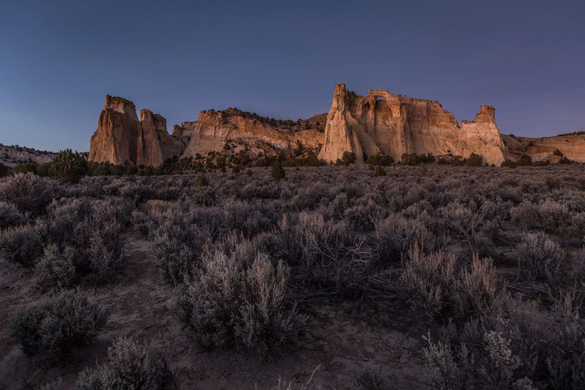
MOJAVE trails national monument, california
The Cadiz Dunes Wilderness is one of the most beautiful sites within the Mojave Trails National Monument. If you want to see a greater selection of photographs from the monument, head here.


To date, President Joe Biden has designated five national monuments since coming to office in 2021. Here we take a look at four of those five national monuments that had a land conservation element, and what might be on the slate before the end of his first term.